Area Overview for LD3 9RL
Photos of LD3 9RL
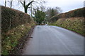
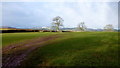
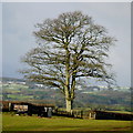
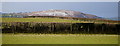
4 photos from this area
Area Information
Key information about the LD3 9RL including its size, population, and administrative classification.
- Area Type
- Postcode
- Area Size
- 25.9 hectares
- Population
- 1309
- Population Density
- 14 people/km²
House Prices in LD3 9RL
13
Properties
£266,714
Average Sold Price
£85,000
Lowest Price
£457,000
Highest Price
Showing 13 properties
| Address | Type | Beds | Baths | Last Sale Price | Last Sale Date | |
|---|---|---|---|---|---|---|
| Ty Clyd, 3 Park View, Llan Ddew, Brecon, LD3 9RL | Bungalow | 4 | 2 | £375,000 | Dec 2024 | |
| 9 Park View, Llan Ddew, Brecon, LD3 9RL | Detached | 4 | 3 | £457,000 | Dec 2023 | |
| 8 Park View, Llan Ddew, Brecon, LD3 9RL | house | - | - | £350,000 | Oct 2020 | |
| 4 Park View, Llan Ddew, Brecon, LD3 9RL | Detached | 3 | 2 | £240,000 | Sep 2014 | |
| 11 Park View, Llan Ddew, Brecon, LD3 9RL | house | - | - | £250,000 | Jun 2004 | |
| 10 Park View, Llan Ddew, Brecon, LD3 9RL | Detached | - | - | £110,000 | Dec 1998 | |
| 12 Park View, Llan Ddew, Brecon, LD3 9RL | house | - | - | £85,000 | Jul 1997 | |
| 2 Park View, Llan Ddew, Brecon, LD3 9RL | Detached | 3 | 1 | - | - | |
| Ty Haf, Park View, Llan Ddew, Brecon, LD3 9RL | Detached | - | - | - | - | |
| 1 Park View, Llan Ddew, Brecon, LD3 9RL | Detached | - | - | - | - |
Page 1 of 2
Energy Efficiency in LD3 9RL
Amenities
Schools
| Rank | School | Type | Entry gender | Ages |
|---|
Explore more schools in this area
Go to Schools tabDemographics
Household Size
Two person
most common
Accommodation Type
Houses
most common
Tenure
80
majority
Ethnic Group
White
most common
Religion
N/A
most common
Household Composition
N/A
most common
Age
47
median
Adults (30-64 years)
most common
Household Deprivation
N/A
with no deprivation
NS-SEC
36
in Lower managerial occupations
Explore more demographic insights in this area
Go to Demographics tabPlanning
Planning Constraints
- Flood RiskPremium
- Ramsar Wetland SitesPremium
- Area of Outstanding Natural BeautyPremium
- Protected Nature ReservePremium
- Protected WoodlandPremium
- Crime RiskPremium