Area Overview for LD3 8AY
Photos of LD3 8AY
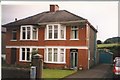

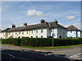

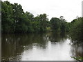


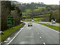
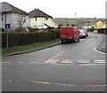
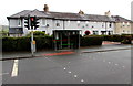
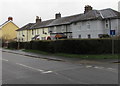
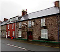
100 photos from this area
Area Information
Key information about the LD3 8AY including its size, population, and administrative classification.
- Area Type
- Postcode
- Area Size
- 4845 m²
- Population
- 1779
- Population Density
- 551 people/km²
House Prices in LD3 8AY
29
Properties
£132,385
Average Sold Price
£30,000
Lowest Price
£223,000
Highest Price
Showing 29 properties
| Address | Type | Beds | Baths | Last Sale Price | Last Sale Date | |
|---|---|---|---|---|---|---|
| 11 Newmarch Street, Llan Faes, Brecon, LD3 8AY | Terraced | 2 | 1 | £150,000 | Apr 2025 | |
| The Kaya, 1A Newmarch Street, Llan Faes, Brecon, LD3 8AY | house | 4 | 1 | £223,000 | Mar 2022 | |
| 51 Newmarch Street, Llan Faes, Brecon, LD3 8AY | Detached | - | - | £150,000 | Feb 2022 | |
| 56 Newmarch Street, Llan Faes, Brecon, LD3 8AY | Terraced | 3 | - | £185,000 | Feb 2022 | |
| 14 Newmarch Street, Llan Faes, Brecon, LD3 8AY | Terraced | 3 | 1 | £170,000 | Dec 2021 | |
| 55 Newmarch Street, Llan Faes, Brecon, LD3 8AY | Terraced | 2 | 1 | £160,000 | Oct 2021 | |
| 13 Newmarch Street, Llan Faes, Brecon, LD3 8AY | house | - | - | £120,000 | May 2021 | |
| 4 Newmarch Street, Llan Faes, Brecon, LD3 8AY | Terraced | 2 | - | £145,000 | Mar 2021 | |
| 1 Newmarch Street, Llan Faes, Brecon, LD3 8AY | Terraced | 4 | 1 | £165,000 | Sep 2017 | |
| 62 Newmarch Street, Llan Faes, Brecon, LD3 8AY | Terraced | 2 | 1 | £112,750 | May 2017 |
Page 1 of 3
Energy Efficiency in LD3 8AY
Amenities
Schools
| Rank | School | Type | Entry gender | Ages |
|---|
Explore more schools in this area
Go to Schools tabDemographics
Household Size
One person
most common
Accommodation Type
Houses
most common
Tenure
52
majority
Ethnic Group
White
most common
Religion
N/A
most common
Household Composition
N/A
most common
Age
47
median
Adults (30-64 years)
most common
Household Deprivation
N/A
with no deprivation
NS-SEC
26
in Lower managerial occupations
Explore more demographic insights in this area
Go to Demographics tabPlanning
Planning Constraints
- Flood RiskPremium
- Ramsar Wetland SitesPremium
- Area of Outstanding Natural BeautyPremium
- Protected Nature ReservePremium
- Protected WoodlandPremium
- Crime RiskPremium