Area Overview for LD3 7LW
Photos of LD3 7LW
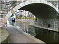
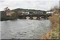
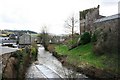
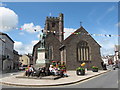
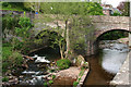
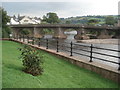
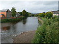
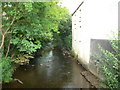
100 photos from this area
Area Information
Key information about the LD3 7LW including its size, population, and administrative classification.
- Area Type
- Postcode
- Area Size
- 4983 m²
- Population
- 1517
- Population Density
- 1989 people/km²
House Prices in LD3 7LW
25
Properties
£154,622
Average Sold Price
£27,500
Lowest Price
£265,000
Highest Price
Showing 25 properties
| Address | Type | Beds | Baths | Last Sale Price | Last Sale Date | |
|---|---|---|---|---|---|---|
| 23 The Struet, Brecon, LD3 7LW | Terraced | 3 | 1 | £255,000 | Jul 2025 | |
| 42 The Struet, Brecon, LD3 7LW | Terraced | 2 | 1 | £139,950 | May 2025 | |
| 21A The Struet, Brecon, LD3 7LW | Terraced | 2 | 1 | £140,000 | May 2025 | |
| 32 The Struet, Brecon, LD3 7LW | Terraced | 4 | 1 | £177,000 | Feb 2025 | |
| 43 The Struet, Brecon, LD3 7LW | Terraced | 2 | 1 | £183,000 | Jun 2023 | |
| 41 The Struet, Brecon, LD3 7LW | Terraced | 2 | 1 | £140,000 | Dec 2022 | |
| 45 The Struet, Brecon, LD3 7LW | Terraced | 5 | - | £240,000 | Aug 2021 | |
| 22 The Struet, Brecon, LD3 7LW | Terraced | 3 | 1 | £165,000 | Feb 2020 | |
| 33 The Struet, Brecon, LD3 7LW | Terraced | 3 | 1 | £108,250 | Oct 2018 | |
| 44 The Struet, Brecon, LD3 7LW | Terraced | 2 | 1 | £115,000 | Oct 2016 |
Page 1 of 3
Energy Efficiency in LD3 7LW
Amenities
Schools
| Rank | School | Type | Entry gender | Ages |
|---|
Explore more schools in this area
Go to Schools tabDemographics
Household Size
One person
most common
Accommodation Type
Houses
most common
Tenure
53
majority
Ethnic Group
White
most common
Religion
N/A
most common
Household Composition
N/A
most common
Age
47
median
Adults (30-64 years)
most common
Household Deprivation
N/A
with no deprivation
NS-SEC
30
in Lower managerial occupations
Explore more demographic insights in this area
Go to Demographics tabPlanning
Planning Constraints
- Flood RiskPremium
- Ramsar Wetland SitesPremium
- Area of Outstanding Natural BeautyPremium
- Protected Nature ReservePremium
- Protected WoodlandPremium
- Crime RiskPremium