Area Overview for LD2 3UH
Photos of LD2 3UH
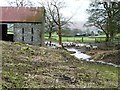
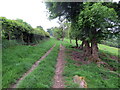
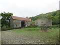
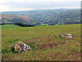
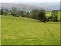
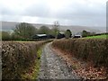
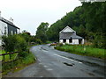
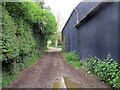
8 photos from this area
Area Information
Key information about the LD2 3UH including its size, population, and administrative classification.
- Area Type
- Postcode
- Area Size
- 2.0 km²
- Population
- 1206
- Population Density
- 10 people/km²
House Prices in LD2 3UH
26
Properties
£194,907
Average Sold Price
£15,840
Lowest Price
£617,500
Highest Price
Showing 26 properties
| Address | Type | Beds | Baths | Last Sale Price | Last Sale Date | |
|---|---|---|---|---|---|---|
| Boatside Barns, B 4567 From Junction With Wye View Aberedw To Junction With U 1329, Llanfaredd, Builth Wells, LD2 3UH | house | - | - | £480,000 | Mar 2025 | |
| 11 Edw Crescent, Aberedw, Builth Wells, LD2 3UH | Terraced | 3 | - | £135,000 | Sep 2021 | |
| 10 Edw Crescent, Aberedw, Builth Wells, LD2 3UH | house | - | - | £230,000 | Jun 2021 | |
| Plas Gwyn, B 4567 From Junction With Wye View Aberedw To Junction With U 1329, Llanfaredd, Builth Wells, LD2 3UH | Detached | 8 | 11 | £617,500 | Aug 2018 | |
| 15 Edw Crescent, Aberedw, Builth Wells, LD2 3UH | house | 3 | 1 | £107,500 | Sep 2017 | |
| By The Wye, C 1334 From Junction With B 4567 Near Wye View Aberedw To Junction With Edw Crescent, Aberedw, Builth Wells, LD2 3UH | Cottage | 2 | - | £189,950 | Aug 2014 | |
| 13 Edw Crescent, Aberedw, Builth Wells, LD2 3UH | Terraced | 3 | 1 | £108,000 | Sep 2012 | |
| 8 Edw Crescent, Aberedw, Builth Wells, LD2 3UH | house | - | - | £117,500 | Jan 2009 | |
| Trefechan, Edw Crescent, Aberedw, Builth Wells, LD2 3UH | Bungalow | - | - | £320,000 | Jul 2007 | |
| 12 Edw Crescent, Aberedw, Builth Wells, LD2 3UH | house | - | - | £73,000 | Sep 2003 |
Page 1 of 3
Energy Efficiency in LD2 3UH
Amenities
Schools
| Rank | School | Type | Entry gender | Ages |
|---|
Explore more schools in this area
Go to Schools tabDemographics
Household Size
Two person
most common
Accommodation Type
Houses
most common
Tenure
77
majority
Ethnic Group
White
most common
Religion
N/A
most common
Household Composition
N/A
most common
Age
47
median
Adults (30-64 years)
most common
Household Deprivation
N/A
with no deprivation
NS-SEC
29
in Lower managerial occupations
Explore more demographic insights in this area
Go to Demographics tabPlanning
Planning Constraints
- Flood RiskPremium
- Ramsar Wetland SitesPremium
- Area of Outstanding Natural BeautyPremium
- Protected Nature ReservePremium
- Protected WoodlandPremium
- Crime RiskPremium