Area Overview for Kerry
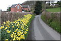
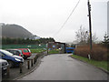
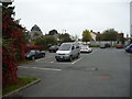
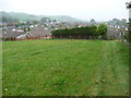
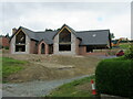
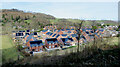
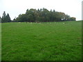
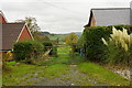
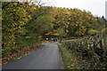
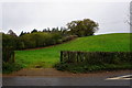
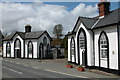
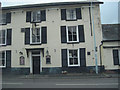
Photos of Kerry
Area Information
Kerry is a built-up area in Wales, spanning 30.3 hectares. Its population is predominantly older, with a median age of 70, suggesting a community shaped by long-term residents. Home ownership is high at 76%, indicating a stable, settled demographic. Daily life in Kerry is supported by nearby amenities, including supermarkets like Morrisons Newtown and Aldi Pool, as well as a railway station at Newtown, which connects residents to broader networks. The area’s broadband score is 100, the highest possible, ensuring seamless digital connectivity for working from home or online activities. While specific data on schools and other demographics is limited, the presence of St. Michael’s C.I.W. School and a range of retail outlets highlights a practical, community-focused environment. Kerry’s compact size and mix of retail and transport options make it a convenient base for those prioritising accessibility over sprawling urban sprawl.
- Area Type
- Built Up Area 250
- Area Size
- 30.3 hectares
- Population
- Not available
- Population Density
- Not available
Kerry’s lifestyle is shaped by its proximity to essential amenities. The area includes five retail outlets, such as Morrisons Newtown, Aldi Pool, and Tesco Newtown, ensuring easy access to shopping and daily necessities. The Newtown Railway Station adds convenience for travel, while the compact size of the area means residents can reach these venues without long commutes. Though parks or leisure facilities are not explicitly listed, the presence of multiple supermarkets and a rail station suggests a practical, service-oriented lifestyle focused on convenience and connectivity.
Amenities
Schools
St. Michael’s C.I.W. School is the only named school near Kerry, though its Ofsted rating is not provided. As a ‘C.I.W.’ (Church in Wales) institution, it likely serves the local community with a focus on faith-based education. Families in Kerry have access to this school, though the absence of additional schools or ratings means the educational landscape is not fully defined. The single school nearby suggests a reliance on this institution for primary or secondary education, with no immediate alternatives for parents seeking diverse options.
| Rank | A + A* % | School | Type | Entry gender | Ages |
|---|---|---|---|---|---|
| 1 | N/A | St. Michael's C.I.W. School | other | N/A | N/A |
Explore more schools in this area
Go to Schools tabDemographics
Kerry’s population has a median age of 70, the highest recorded, indicating a community largely composed of older residents. Home ownership stands at 76%, suggesting a strong presence of long-term property owners. While data on household composition, accommodation types, and ethnic diversity is aggregated as ‘total’, the high home ownership rate points to a stable, low-turnover area. This demographic profile likely influences the area’s character, with a focus on established neighbourhoods and services tailored to older residents. The absence of specific figures on deprivation or diversity means broader quality-of-life implications remain unquantified, but the age profile and ownership levels suggest a mature, settled community.
Household Size
Accommodation Type
Tenure
Ethnic Group
Religion
Household Composition
Age
Household Deprivation
NS-SEC
Explore more demographic insights in this area
Go to Demographics tabPlanning
Planning Constraints
- Crime RiskLocked