Area Overview for Disserth and Trecoed Community
Photos of Disserth and Trecoed Community
Area Information
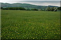
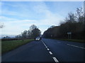
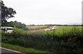
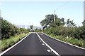
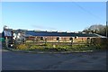
Disserth and Trecoed Community is a distinct civil parish covering an area of 31.2 km². This rural setting offers a quiet lifestyle for those who prefer a slower pace away from urban centres. You will find that daily life here revolves around local neighbourhoods rather than high-density city living. The area lacks major planning constraints such as Areas of Outstanding Natural Beauty or Ramsar wetland sites, which suggests lower restrictions on local development compared to more protected zones. However, the presence of protected nature reserves and woodlands indicates that the landscape holds significant environmental value. Living in Disserth and Trecoed Community means accepting a rural environment with specific conservation boundaries. The community's character is defined by its size and its mix of residential areas with natural spaces. You can explore large swathes of land without facing the typical constraints of highly protected conservation sites, yet you remain close to areas designated for nature protection. This balance creates a setting where you enjoy open skies and green spaces while avoiding the strict planning rules that often accompany such designations. The parish provides a established framework for rural living without the complexities of major protected zones.
- Area Type
- Parish
- Area Size
- 31.2 km²
- Population
- Not available
- Population Density
- Not available
Demographics
The residents of Disserth and Trecoed Community reflect a mature demographic profile with a median age of 70 years. The most common age range encompasses the total population, indicating a significant proportion of elderly residents. You will discover that 77% of homes in this community are owner-occupied. This high rate of ownership suggests a stable population with deep community ties rather than a transient rental market. The majority of households are permanent residents who have settled over time. Accommodation data confirms that the housing stock caters primarily to long-term living arrangements rather than short-term lets. The area's ethnic composition and religious diversity are part of the standard parish census data, contributing to a settled local identity. There is a clear focus on total age demographics, meaning you will encounter a community where older adults form the backbone of society. Living in Disserth and Trecoed Community involves integrating into a society where family life often centers around older generations. The household composition reflects a preference for staying in one place rather than frequent moving. This stability is evident in the ownership figures and the age structure of the populace.
Household Size
Accommodation Type
Tenure
Ethnic Group
Religion
Household Composition
Age
Household Deprivation
NS-SEC
Explore more demographic insights in this area
Go to Demographics tabPlanning
Planning Constraints
- Flood RiskPremium
- Ramsar Wetland SitesPremium
- Area of Outstanding Natural BeautyPremium
- Protected Nature ReservePremium
- Protected WoodlandPremium
- Crime RiskPremium