Area Overview for Cwmdu and District Community
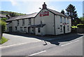
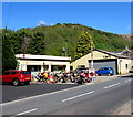
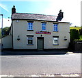
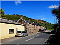
Photos of Cwmdu and District Community
Area Information
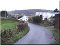
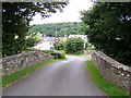
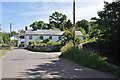
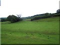
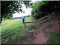
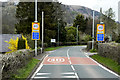
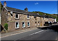
Living in Cwmdu and District Community offers a defined sense of place within a civil parish that spans 45.0 km². You will find yourself in a setting where the landscape shapes daily life, distinct from the high-density urban cores nearby. The area is characterised by its rural nature, providing a different pace of living for those who choose this location. Understanding the landscape requires acknowledging the physical constraints present within the parish boundaries. You are entering an environment where planning rules are influenced by local features rather than generic regional policies. The size of the parish suggests a spread-out community where local amenities may require travel beyond the immediate vicinity. Homes in Cwmdu and District Community exist within a framework of local governance that manages these parcelled lands. Your daily routine will be shaped by the distance between your new home and essential services located outside the parish limits.
- Area Type
- Parish
- Area Size
- 45.0 km²
- Population
- Not available
- Population Density
- Not available
Demographics
The population profile of Cwmdu and District Community shows a significant deviation from national averages. The median age here stands at 70 years, indicating a community dominated by older residents. You can expect to see a demographic skew towards retirees rather than families with young children or young professionals. This age distribution influences the types of social activities available and the demand for specific local services. Home ownership levels are high, with 77% of households owning their property outright. This figure suggests a stable resident base where long-term tenure is the norm for the majority of people living in Cwmdu and District Community. Accommodation types reflect this ownership dominance, though specific breakdowns of house versus bungalow types are not detailed in the available records. The community composition is largely singular in terms of age, which creates specific social dynamics for anyone considering moving here. You will find that the social fabric is built around the needs and rhythms of an older generation.
Household Size
Accommodation Type
Tenure
Ethnic Group
Religion
Household Composition
Age
Household Deprivation
NS-SEC
Explore more demographic insights in this area
Go to Demographics tabPlanning
Planning Constraints
- Flood RiskPremium
- Ramsar Wetland SitesPremium
- Area of Outstanding Natural BeautyPremium
- Protected Nature ReservePremium
- Protected WoodlandPremium
- Crime RiskPremium