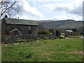
Area Overview for Talgarth Community
Photos of Talgarth Community

Area Information
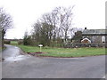
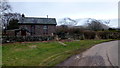
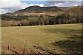
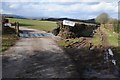
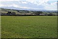
Living in Talgarth Community offers a distinct character defined by its rural location within Wales. This civil parish covers a substantial 55.3 km², providing a sense of spaciousness that is absent in more densely populated Welsh towns. The area stands apart from typical urban centres due to its status as a parish, which often implies a strong local identity centred around village life rather than metropolitan commuting. You will find that daily life here revolves around the practicalities of country living, where independence from city noise is a primary draw. The sheer size of the territory means there is significant open space surrounding residential clusters, offering privacy and quiet for those who prioritise a slower pace. Prospective residents should understand that moving to Talgarth Community is a decision for someone seeking space and a traditional Welsh neighbourhood atmosphere over proximity to major infrastructure. The environment here is defined by its natural landscape characteristics and the administrative separation from larger council districts. Your experience of the area will be shaped by this specific civil boundaries and the resulting limited commercial density. It is a place where the focus remains firmly on local geography and community integration rather than regional connectivity hubs.
- Area Type
- Parish
- Area Size
- 55.3 km²
- Population
- Not available
- Population Density
- Not available
Demographics
The population profile within Talgarth Community reflects a settlement with a significantly older demographic structure. You will find that the median age is 70 years old, placing this parish well above the national average for Wales. This high median age indicates that the community is predominantly inhabited by seniors or retirees. A large proportion of the total population falls into the age groups associated with older adulthood, which shapes the entire social rhythm of the area. Household composition is consequently skewed towards empty nesters or retired couples who have settled in the parish for the long term. The area maintains a high level of property stability, with 66% of residents owning their homes outright or via mortgage. This indicates a settled community where house prices are dictated by local fixed incomes and pension wealth rather than young family migration. Accommodation types and predominant ethnic groups are not detailed in the current census breakdown for this specific parish, but the overall picture points to a homogenous, traditional community structure. You should expect a quiet environment where neighbours know one another through generations rather than through recent transactions or new arrival schemes.
Household Size
Accommodation Type
Tenure
Ethnic Group
Religion
Household Composition
Age
Household Deprivation
NS-SEC
Explore more demographic insights in this area
Go to Demographics tabPlanning
Planning Constraints
- Flood RiskPremium
- Ramsar Wetland SitesPremium
- Area of Outstanding Natural BeautyPremium
- Protected WoodlandPremium
- Crime RiskPremium