Area Overview for Old Radnor Community
Photos of Old Radnor Community

Area Information
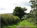
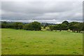
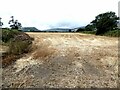
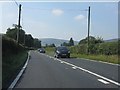
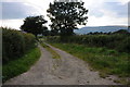
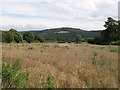
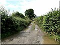
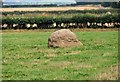
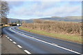
Old Radnor Community is a civil parish in Wales covering an expanse of 51.1 km². This substantial size defines the character of daily life here, offering a landscape that extends well beyond a typical village footprint. Living in Old Radnor Community means navigating a terrain where residential areas sit alongside significant natural features. The land area is large enough to include protected woodland, yet there are no Ramsar wetland sites or Areas of Outstanding Natural Beauty within its boundaries. This mix shapes the local environment and influences planning constraints for any future development. The community feels established and settled. With a median age of 70, the demographic profile suggests a region where long-term residents have stayed for generations. High levels of home ownership reinforce this sense of permanence, creating an environment where property changes hands less frequently than in younger populations. There is a distinct lack of transient urban energy. Instead, life revolves around the pace of a rural parish where movement is measured in local routes rather than rush hour traffic. Families considering homes in Old Radnor Community should be aware that this is an area designed for those who value space and quiet over convenience and speed. The 51.1 km² scale ensures that quiet periods are the norm, making it an unassumingly peaceful place to settle down.
- Area Type
- Parish
- Area Size
- 51.1 km²
- Population
- Not available
- Population Density
- Not available
Demographics
The social fabric of Old Radnor Community reflects a population that has matured. The median age stands at 70 years, indicating that the majority of residents are senior citizens. Age distributions show that the total population skews heavily towards older age brackets, with no younger demographic holding significant weight. This profile results in a community where energy levels and daily routines are dictated by stability rather than rapid change. Home ownership is the defining economic characteristic of this parish. A striking 76% of households own their properties outright or have a significant mortgage. This high rate suggests a substantial retirement community or a district where assets are often passed down through generations. Such ownership levels imply lower rental turnover and potentially fewer transient students or young professionals moving through the area. The household composition data confirms that the total population is structured around these established families and individuals. Diversity data does not break down specific ethnic groups or religious affiliations in the available records. However, the homogeneity of the home ownership rate and the age profile provide a clear picture of social continuity. Living here means joining a community where decisions and social dynamics have remained consistent for decades. The high percentage of owners also suggests that local education pots or community funds may rely heavily on long-term residency rather than fluctuating rental demographics.
Household Size
Accommodation Type
Tenure
Ethnic Group
Religion
Household Composition
Age
Household Deprivation
NS-SEC
Explore more demographic insights in this area
Go to Demographics tabPlanning
Planning Constraints
- Flood RiskPremium
- Ramsar Wetland SitesPremium
- Area of Outstanding Natural BeautyPremium
- Protected Nature ReservePremium
- Protected WoodlandPremium
- Crime RiskPremium