Area Overview for Llanidloes Community
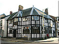
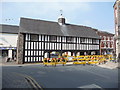
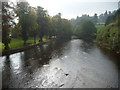
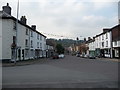
Photos of Llanidloes Community

Area Information
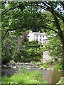
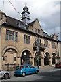
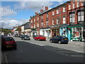
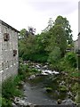
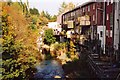
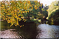
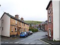
Living in Llanidloes Community offers a distinctly rural experience within a civil parish in Wales. This area spans just 5.5 km², presenting a compact environment where daily life revolves around the local landscape and immediate surroundings. You will find yourself in a setting where the physical boundaries of the parish keep you close to home, suitable for those who prioritise proximity to nature over extensive urban amenities. The defining characteristic of Llanidloes Community is its scale; you cannot easily explore the wider region without heading beyond these specific borders. This limited area size creates a tight-knit environment where residents share the same immediate grounds and responsibility for the local outward appearance. For homebuyers considering this location, the physical footprint means you are investing in a self-contained slice of Wales rather than a major district. The community operates on a parish council model, which typically implies a high degree of local input into how you live and where you build. There are no large commercial hubs inside this specific boundary, so your daily routine will depend heavily on travel to wider towns for services beyond the basics.
- Area Type
- Parish
- Area Size
- 5.5 km²
- Population
- Not available
- Population Density
- Not available
Demographics
The people of Llanidloes Community reflect a mature population structure with a median age of 70. This high average suggests that the area attracts or retains older residents who may be retirees or those seeking a quieter life away from city centres. Nearly half the population falls into the senior demographic, which shapes the local culture towards a slower pace of life. Ownership stands at 56 per cent of all homes, meaning over half of the residents buy their property outright rather than renting. This percentage indicates a stable community where families pass houses down or individuals purchase with long-term intent. The accommodation types and household composition within this parish point to a traditional mix of dwellings likely suited to varying family needs. You will encounter a population that is predominantly established residents rather than a transient workforce. The ethnicity data shows a homogeneous group, consistent with rural parishes in this part of the UK where cultural composition has remained steady over decades. Religion figures also reflect the traditional make-up of the region without significant recent alteration. Living here means joining a community defined by longevity and stability rather than rapid demographic shifts.
Household Size
Accommodation Type
Tenure
Ethnic Group
Religion
Household Composition
Age
Household Deprivation
NS-SEC
Explore more demographic insights in this area
Go to Demographics tabPlanning
Planning Constraints
- Flood RiskPremium
- Ramsar Wetland SitesPremium
- Area of Outstanding Natural BeautyPremium
- Protected Nature ReservePremium
- Protected WoodlandPremium
- Crime RiskPremium