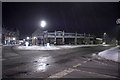
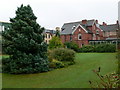
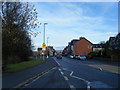
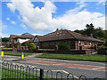
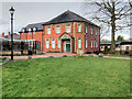
Area Overview for Llandrindod Wells Community
Photos of Llandrindod Wells Community


Area Information
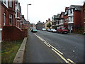
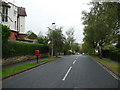
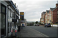
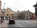
Llandrindod Wells Community is a civil parish covering 12.7 km² in Wales. It functions as a distinct parish with defined boundaries and a clear local identity. The area sits within a specific geographical context that shapes daily life for its residents. Living in Llandrindod Wells Community involves navigating a landscape that combines rural characteristics with established residential infrastructure. The parish offers a specific environment where residents face practical realities regarding space and services. You can expect a quiet setting defined by its size and administrative classification. Homes in Llandrindod Wells Community are situated within this bounded territory of approximately 12.7 square kilometres. The area provides a settled locale where the community operates under the governance of a civil parish. Prospective buyers should understand the scope of this parish when considering their future home. The physical extent of the parish influences how services are delivered and how distance is measured. You are looking at a defined residential zone rather than a sprawling metropolitan district. The factual reality is that this is a parish with specific dimensions and administrative standing in Wales.
- Area Type
- Parish
- Area Size
- 12.7 km²
- Population
- Not available
- Population Density
- Not available
Demographics
The population profile of Llandrindod Wells Community reflects an older demographic structure. The median age for residents is 70, indicating a community with a significant proportion of senior citizens. Most common age groups skew towards older brackets, suggesting fewer young families reside here compared to urban centres. This age distribution influences local services and the pace of daily life within the parish. Home ownership stands at 56%, showing that just over half of households have bought their property. The remaining 44% of households consist of renters or shared ownership arrangements. Accommodation types in Llandrindod Wells Community vary, though specific breakdowns by terraced, semi-detached, or detached structures are not detailed in current records. The high median age means schools near Llandrindod Wells Community serve fewer young children relative to the total population size. Household composition mirrors this older population, with many homes likely housing single occupants or couples nearing retirement. There is no data currently available to specify the predominant ethnic group or religious affiliation for the parish. You should expect a community where records show a very specific age demographic rather than a broad spread of youth.
Household Size
Accommodation Type
Tenure
Ethnic Group
Religion
Household Composition
Age
Household Deprivation
NS-SEC
Explore more demographic insights in this area
Go to Demographics tabPlanning
Planning Constraints
- Flood RiskPremium
- Ramsar Wetland SitesPremium
- Area of Outstanding Natural BeautyPremium
- Protected Nature ReservePremium
- Protected WoodlandPremium
- Crime RiskPremium