Area Overview for Guilsfield Community
Photos of Guilsfield Community
Area Information
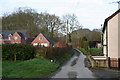
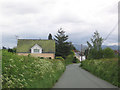
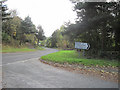
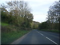
Guilsfield Community is a civil parish in Wales covering an area of 30.0 km². The vast size relative to its population suggests a spacious, low-density landscape typical of the Welsh countryside. When considering living in Guilsfield Community, you are entering a rural setting defined by wide open spaces rather than dense urban clusters. The parish design implies a local governance structure focused on community needs across this significant footprint. Daily life here revolves around the natural environment and the slower pace associated with areas of this scale. You will find that homes in Guilsfield Community are set within a context where distances between settlements can be considerable. The area offers a distinct separation from the busier markets of larger town centres. Your experience will depend largely on your personal vehicle access, given the rural nature of the neighbourhood. This substantial land area provides room for dispersal and solitude, which contrasts sharply with the crowded lifestyle found in major Welsh cities. Choosing to move to this parish means accepting a lifestyle where convenience often requires planning. The sheer size of the territory shapes every aspect of your routine, from shopping trips to social engagements with neighbours.
- Area Type
- Parish
- Area Size
- 30.0 km²
- Population
- Not available
- Population Density
- Not available
Demographics
The demographic profile of Guilsfield Community reveals a settlement with a distinctly older population. The median age stands at 70 years, indicating that the majority of residents are senior citizens. When looking for schools near Guilsfield Community, you must recognise that the local population is primarily post-retirement. This age skew defines the social dynamics and services required within the parish. Home ownership levels are exceptionally high at 77%. This figure confirms that the vast majority of households in Guilsfield Community have purchased their dwellings rather than renting. The year-round housing profile is shaped by these established owners who have taken root in the area. While specific data on household composition and predominant ethnic groups are not detailed in current records, the ownership rate suggests long-term stability. Deprivation metrics are not provided, but the high rate of ownership often correlates with established community integration. You will likely encounter a community where generations have remained in the same location for decades. The environment caters to those seeking quiet retirement rather than young families or transient workers. This demographic reality affects everything from local events to the types of amenities that remain open or expand.
Household Size
Accommodation Type
Tenure
Ethnic Group
Religion
Household Composition
Age
Household Deprivation
NS-SEC
Explore more demographic insights in this area
Go to Demographics tabPlanning
Planning Constraints
- Flood RiskPremium
- Ramsar Wetland SitesPremium
- Area of Outstanding Natural BeautyPremium
- Protected Nature ReservePremium
- Protected WoodlandPremium
- Crime RiskPremium