Area Overview for Churchstoke Community
Photos of Churchstoke Community
Area Information
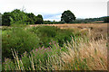
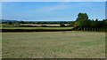
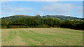
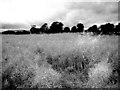
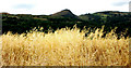
Living in Churchstoke Community offers a distinctly rural Welsh experience within a civil parish that spans 50.2 square kilometres. You are situated in a large, open landscape where space is the primary characteristic of daily life. This area does not function as a traditional town or village centre; instead, it represents a broad administrative region covering significant open land. Most residents navigate this territory by car, given the vast distances between scattered dwellings and amenities. The community exudes a quiet atmosphere defined by its expansive footprint rather than dense urban activity. People choosing homes in Churchstoke Community typically value privacy and proximity to the countryside over access to immediate high-density services. The sheer size of the parish means that facilities often require travel to nearby towns for shopping or social engagement. This layout suits those who prefer a settled, low-density environment. When you consider local living options here, you find yourselves surrounded by nature rather than office blocks or crowded streets. The civil parish structure provides a clear administrative boundary, but the physical reality is one of wide-open spaces stretching across the Welsh countryside. Your experience will be shaped by the autonomy of this large, self-contained area where neighbours may be kilometres apart rather than metres.
- Area Type
- Parish
- Area Size
- 50.2 km²
- Population
- Not available
- Population Density
- Not available
Demographics
The population of Churchstoke Community reflects a mature community with a median age of 70 years. This figure places the area well above the national average and indicates a significant cohort of retirees calling this parish home. You will find that the most common age grouping falls within this elderly demographic, creating a neighbourhood dynamic focused on established, long-term residents rather than young families moving in. Such an age profile influences local services and community activity, catering specifically to the needs of older adults. Home ownership stands at an impressive 74% within the parish. This high rate suggests a population deeply rooted in the area, building equity over decades and rarely moving within short timeframes. The stability of residents contributes to a predictable local environment. While the data does not break down specific accommodation types or the predominant ethnic groups, the overall picture points to a stable, older household composition. Deprivation metrics are not available for this specific Welsh parish, but the high level of home ownership often correlates with financial security among the resident population. When you look at who lives here, you see a community characterised by longevity in residence and stability in housing tenure rather than transient tenancy.
Household Size
Accommodation Type
Tenure
Ethnic Group
Religion
Household Composition
Age
Household Deprivation
NS-SEC
Explore more demographic insights in this area
Go to Demographics tabPlanning
Planning Constraints
- Flood RiskPremium
- Ramsar Wetland SitesPremium
- Protected Nature ReservePremium
- Protected WoodlandPremium
- Crime RiskPremium