Area Overview for St Dogmaels
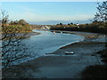
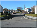
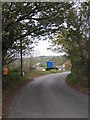
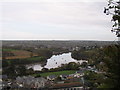
Photos of St Dogmaels


Area Information
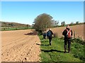
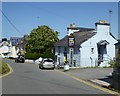
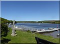
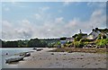
Living in St Dogmaels means calling home a built-up area defined by its quiet character and strong sense of community. The locality is a distinct Welsh settlement with a total area size of 54.7 hectares. This space accommodates a population where the median age sits at 70 years. You will find that daily life here revolves around a slower pace compared to larger cities. The area functions as a stable residential zone rather than a commercial hub. Families and individuals seeking a settled environment will appreciate the compact nature of the town. The layout encourages walking between homes and local facilities. You do not need a car for short trips within these boundaries. The setting provides a clear alternative to more densely populated locations in Wales.
- Area Type
- Built Up Area 250
- Area Size
- 54.7 hectares
- Population
- Not available
- Population Density
- Not available
Daily conveniences for residents of St Dogmaels are concentrated in Cardigan, the nearest larger town. You can access practical retail needs through three main establishments range within practical reaching distance. Spar operates as a local convenience store for quick daily items. Aldi Cardigan offers larger groceries for home stockpiling. Tesco Cardigan provides a full supermarket experience for household shopping. These venues ensure you do not struggle for basic necessities without a car journey. Other amenities such as dining or leisure facilities are not explicitly listed in the immediate nearest data set for this specific town. The retail landscape is functional rather than extensive. You will find that the shopping provision caters to essential needs rather than luxury or specialty items. The presence of these three key retailers anchors the practical lifestyle of those calling St Dogmaels home.
Amenities
Schools
Educational options for families reside in close proximity to the main settlement. St Dogmaels is the primary school located within the built-up area. This institution serves as the main educational hub for local children. It operates as a local authority or special type of school rather than a specialist academy. Currently, no other named schools appear in the immediate vicinity of the towns. For families requiring additional options, you must look beyond this specific built-up area. The local school types do not include comprehensive or selective educational facilities within the immediate data set. This limited selection means you may need to consider boarding arrangements or travel to Cardigan for secondary education. When you evaluate homes in St Dogmaels, factor in the distance to further secondary institutions. The presence of St Dogmaels school confirms that primary education is locally accessible without major travel requirements.
| Rank | School | Type | Entry gender | Ages |
|---|
Explore more schools in this area
Go to Schools tabDemographics
The community in St Dogmaels reflects a predominantly older demographic profile. The median age is 70 years, indicating a settlement where long-term residents make up the majority of the population. Census data shows the most common age range covers the total population, suggesting a shift away from younger family clusters. This demographic shift influences the character of neighbourhood interactions and local demand services. A significant proportion of the population owns their home outright. Home ownership stands at 64 per cent, which exceeds national averages for many rural Welsh towns. This high rate suggests stability within the household composition. You will find that the accommodation types are largely purpose-built for settled living rather than transient tenancy. The area does not reflect the high diversity seen in major urban centres. Instead, it maintains a traditional household structure aligned with retirement and quiet retirement living.
Household Size
Accommodation Type
Tenure
Ethnic Group
Religion
Household Composition
Age
Household Deprivation
NS-SEC
Explore more demographic insights in this area
Go to Demographics tabPlanning
Planning Constraints
- Crime RiskPremium