Area Overview for Scleddau Community
Photos of Scleddau Community
Area Information
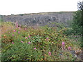
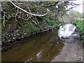
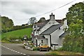
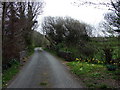
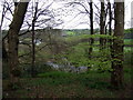
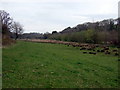
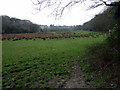
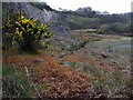
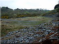
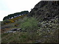
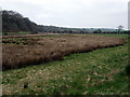
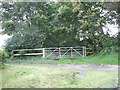
You will find Scleddau Community positioned two miles south of Fishguard on the main A40 road. This civil parish occupies an area of 35.2 km² and sits at the convergence of the ancient parishes of Llanstinan, Manorowen, and Fishguard. The Western Cleddau river flows directly under the primary road through the settlement, fed by several local springs. You are walking distance from Grade II* listed Llanstinan parish church, dedicated to St Justinian, which lies one mile to the east. Nearby Sion Chapel, constructed in 1859, stands as one of twenty-four listed buildings within the community. History defines the daily rhythm here, marked by prehistoric monuments like the round barrow on Jordanston Hill and the village's role in the Rebecca Riots of the 1840s. The destruction of the local tollgate on 27 June 1843 remains a recorded event from that turbulent period. You live in a setting shaped by these ancient roots and rural transport links. The area offers a quiet existence where the road network connects you directly to Fishguard while maintaining separation from the larger town. Your grounds or garden might overlook protected woodland or nature reserves, features that define the landscape boundaries of this parish.
- Area Type
- Parish
- Area Size
- 35.2 km²
- Population
- Not available
- Population Density
- Not available
Demographics
The population profile of Scleddau Community reveals a settlement dominated by older residents. The median age across the area is seventy years, indicating a post-retirement demographic. Your immediate neighbours are likely to be fellow retirees or older couples rather than young families. Household composition reflects this age reality, with a significant portion of the population falling into the 'Total' age bracket category as recorded in the census data. True independence from fire sales and mortgage cram jägs characterises the local housing market. A staggering 68% of residents are homeowners, meaning you are joining a community where property ownership is the norm rather than the exception. This high ownership rate suggests economic stability for many people who have lived here for decades. Accommodation types mirror the historic nature of the village, with many homes occupied by lifelong residents. You will find that the ethnic makeup of the area is historically settled, with one predominant group forming the vast majority of the population. Religious affiliation here aligns with the area's deep ecclesiastical heritage. The presence of multiple listed places of worship indicates a community where church attendance may remain a significant social activity. You are not surrounded by transient populations but by a static, established group of people who value the continuity of the village structure.
Household Size
Accommodation Type
Tenure
Ethnic Group
Religion
Household Composition
Age
Household Deprivation
NS-SEC
Explore more demographic insights in this area
Go to Demographics tabPlanning
Planning Constraints
- Flood RiskPremium
- Ramsar Wetland SitesPremium
- Area of Outstanding Natural BeautyPremium
- Protected Nature ReservePremium
- Protected WoodlandPremium
- Crime RiskPremium