Area Overview for SA73 3RJ
Photos of SA73 3RJ
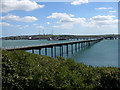
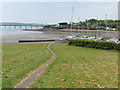
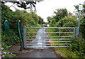
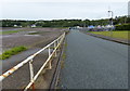
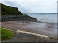
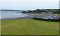
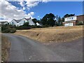
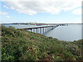


51 photos from this area
Area Information
Key information about the SA73 3RJ including its size, population, and administrative classification.
- Area Type
- Postcode
- Area Size
- 7.1 hectares
- Population
- 1330
- Population Density
- 2463 people/km²
House Prices in SA73 3RJ
25
Properties
£186,567
Average Sold Price
£75,000
Lowest Price
£315,000
Highest Price
Showing 25 properties
| Address | Type | Beds | Baths | Last Sale Price | Last Sale Date | |
|---|---|---|---|---|---|---|
| 20 Bay View Drive, Hakin, Milford Haven, SA73 3RJ | Bungalow | 3 | 1 | £191,500 | Apr 2025 | |
| 23 Bay View Drive, Hakin, Milford Haven, SA73 3RJ | Bungalow | 3 | 1 | £190,000 | Jun 2023 | |
| 5 Bay View Drive, Hakin, Milford Haven, SA73 3RJ | Bungalow | 3 | 2 | £315,000 | Oct 2022 | |
| 15 Bay View Drive, Hakin, Milford Haven, SA73 3RJ | Bungalow | - | - | £234,999 | Jun 2021 | |
| Vista Del Mar, 8A Bay View Drive, Hakin, Milford Haven, SA73 3RJ | Detached | 4 | 2 | £248,000 | Feb 2021 | |
| 3 Bay View Drive, Hakin, Milford Haven, SA73 3RJ | Bungalow | 3 | 2 | £185,000 | Mar 2020 | |
| 10 Bay View Drive, Hakin, Milford Haven, SA73 3RJ | Detached | 4 | 2 | £250,000 | Oct 2018 | |
| 7 Bay View Drive, Hakin, Milford Haven, SA73 3RJ | Bungalow | 3 | 1 | £120,000 | Sep 2018 | |
| 21 Bay View Drive, Hakin, Milford Haven, SA73 3RJ | Bungalow | 3 | 1 | £190,000 | Feb 2017 | |
| 11 Bay View Drive, Hakin, Milford Haven, SA73 3RJ | Bungalow | 3 | 1 | £144,000 | Sep 2016 |
Page 1 of 3
Energy Efficiency in SA73 3RJ
Amenities
Schools
| Rank | School | Type | Entry gender | Ages |
|---|
Explore more schools in this area
Go to Schools tabDemographics
Household Size
Family (3-5 people)
most common
Accommodation Type
Houses
most common
Tenure
44
majority
Ethnic Group
White
most common
Religion
N/A
most common
Household Composition
N/A
most common
Age
47
median
Adults (30-64 years)
most common
Household Deprivation
N/A
with no deprivation
NS-SEC
14
in Lower managerial occupations
Explore more demographic insights in this area
Go to Demographics tabPlanning
Planning Constraints
- Flood RiskPremium
- Ramsar Wetland SitesPremium
- Area of Outstanding Natural BeautyPremium
- Protected Nature ReservePremium
- Protected WoodlandPremium
- Crime RiskPremium