Area Overview for SA73 3NW
Photos of SA73 3NW


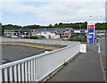
100 photos from this area
Area Information
Key information about the SA73 3NW including its size, population, and administrative classification.
- Area Type
- Postcode
- Area Size
- 8328 m²
- Population
- 1641
- Population Density
- 376 people/km²
House Prices in SA73 3NW
17
Properties
£105,050
Average Sold Price
£33,000
Lowest Price
£305,000
Highest Price
Showing 17 properties
| Address | Type | Beds | Baths | Last Sale Price | Last Sale Date | |
|---|---|---|---|---|---|---|
| 68 Camuset Close, Hakin, Milford Haven, SA73 3NW | Bungalow | 3 | 1 | £305,000 | Mar 2022 | |
| 66 Camuset Close, Hakin, Milford Haven, SA73 3NW | house | - | - | £119,999 | Dec 2021 | |
| 67 Camuset Close, Hakin, Milford Haven, SA73 3NW | Bungalow | 3 | 1 | £235,000 | Aug 2021 | |
| 57 Camuset Close, Hakin, Milford Haven, SA73 3NW | Terraced | 3 | - | £80,000 | Jun 2014 | |
| 60 Camuset Close, Hakin, Milford Haven, SA73 3NW | house | - | - | £59,950 | Oct 2003 | |
| 55 Camuset Close, Hakin, Milford Haven, SA73 3NW | Terraced | 3 | 1 | £35,000 | Jan 2002 | |
| 63 Camuset Close, Hakin, Milford Haven, SA73 3NW | Terraced | - | - | £40,500 | Sep 2001 | |
| 54 Camuset Close, Hakin, Milford Haven, SA73 3NW | Terraced | - | - | £33,000 | Nov 1999 | |
| 65 Camuset Close, Hakin, Milford Haven, SA73 3NW | Terraced | - | - | £37,000 | Mar 1995 | |
| 62 Camuset Close, Hakin, Milford Haven, SA73 3NW | Terraced | 3 | 2 | - | - |
Page 1 of 2
Energy Efficiency in SA73 3NW
Amenities
Schools
| Rank | School | Type | Entry gender | Ages |
|---|
Explore more schools in this area
Go to Schools tabDemographics
Household Size
Two person
most common
Accommodation Type
Houses
most common
Tenure
64
majority
Ethnic Group
White
most common
Religion
N/A
most common
Household Composition
N/A
most common
Age
47
median
Adults (30-64 years)
most common
Household Deprivation
N/A
with no deprivation
NS-SEC
24
in Lower managerial occupations
Explore more demographic insights in this area
Go to Demographics tabPlanning
Planning Constraints
- Flood RiskPremium
- Ramsar Wetland SitesPremium
- Area of Outstanding Natural BeautyPremium
- Protected Nature ReservePremium
- Protected WoodlandPremium
- Crime RiskPremium