Area Overview for SA73 3NA
Photos of SA73 3NA
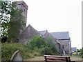
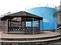
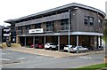
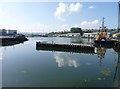
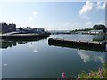
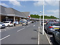

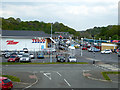
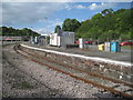
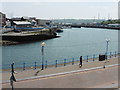
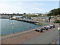
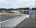
100 photos from this area
Area Information
Key information about the SA73 3NA including its size, population, and administrative classification.
- Area Type
- Postcode
- Area Size
- 7035 m²
- Population
- 1144
- Population Density
- 4598 people/km²
House Prices in SA73 3NA
24
Properties
£96,365
Average Sold Price
£4,400
Lowest Price
£160,000
Highest Price
Showing 24 properties
| Address | Type | Beds | Baths | Last Sale Price | Last Sale Date | |
|---|---|---|---|---|---|---|
| 15 St Lawrence Avenue, Hakin, Milford Haven, SA73 3NA | Terraced | 3 | 1 | £160,000 | May 2025 | |
| 23 St Lawrence Avenue, Hakin, Milford Haven, SA73 3NA | Semi-detached | 3 | 1 | £140,000 | Aug 2023 | |
| 10 St Lawrence Avenue, Hakin, Milford Haven, SA73 3NA | Semi-detached | 3 | 1 | £107,000 | Jun 2020 | |
| 20 St Lawrence Avenue, Hakin, Milford Haven, SA73 3NA | house | 2 | 1 | £4,400 | Aug 2019 | |
| 13 St Lawrence Avenue, Hakin, Milford Haven, SA73 3NA | Terraced | 2 | 1 | £88,250 | Nov 2018 | |
| 6 St Lawrence Avenue, Hakin, Milford Haven, SA73 3NA | Terraced | 2 | 1 | £81,000 | Jan 2017 | |
| 3 St Lawrence Avenue, Hakin, Milford Haven, SA73 3NA | Semi-detached | 3 | 2 | £85,000 | Feb 2016 | |
| 19 St Lawrence Avenue, Hakin, Milford Haven, SA73 3NA | house | - | - | £80,000 | Jul 2013 | |
| 1 St Lawrence Avenue, Hakin, Milford Haven, SA73 3NA | house | - | - | £90,000 | Dec 2012 | |
| 24 St Lawrence Avenue, Hakin, Milford Haven, SA73 3NA | Terraced | - | - | £128,000 | Dec 2008 |
Page 1 of 3
Energy Efficiency in SA73 3NA
Amenities
Schools
| Rank | School | Type | Entry gender | Ages |
|---|
Explore more schools in this area
Go to Schools tabDemographics
Household Size
One person
most common
Accommodation Type
Houses
most common
Tenure
54
majority
Ethnic Group
White
most common
Religion
N/A
most common
Household Composition
N/A
most common
Age
47
median
Adults (30-64 years)
most common
Household Deprivation
N/A
with no deprivation
NS-SEC
19
in Lower managerial occupations
Explore more demographic insights in this area
Go to Demographics tabPlanning
Planning Constraints
- Flood RiskPremium
- Ramsar Wetland SitesPremium
- Area of Outstanding Natural BeautyPremium
- Protected Nature ReservePremium
- Protected WoodlandPremium
- Crime RiskPremium