Area Overview for SA73 3HU
Photos of SA73 3HU
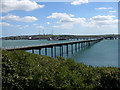
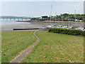
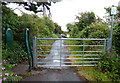
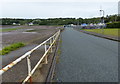
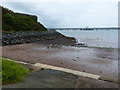
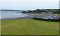
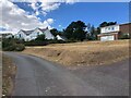
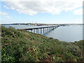
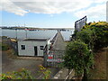


51 photos from this area
Area Information
Key information about the SA73 3HU including its size, population, and administrative classification.
- Area Type
- Postcode
- Area Size
- 1.1 hectares
- Population
- 1330
- Population Density
- 2463 people/km²
House Prices in SA73 3HU
40
Properties
£88,308
Average Sold Price
£20,000
Lowest Price
£151,000
Highest Price
Showing 40 properties
| Address | Type | Beds | Baths | Last Sale Price | Last Sale Date | |
|---|---|---|---|---|---|---|
| 65 John Lewis Street, Hakin, Milford Haven, SA73 3HU | Flat | 2 | - | £52,000 | Aug 2025 | |
| 13 John Lewis Street, Hakin, Milford Haven, SA73 3HU | house | 3 | 1 | £151,000 | Jul 2024 | |
| 83 John Lewis Street, Hakin, Milford Haven, SA73 3HU | Terraced | 3 | 1 | £126,000 | May 2024 | |
| 67 John Lewis Street, Hakin, Milford Haven, SA73 3HU | Flat | 2 | 1 | £56,000 | Apr 2024 | |
| 35 John Lewis Street, Hakin, Milford Haven, SA73 3HU | Flat | - | - | £57,000 | Apr 2023 | |
| 31 John Lewis Street, Hakin, Milford Haven, SA73 3HU | house | - | - | £90,000 | Dec 2022 | |
| 53 John Lewis Street, Hakin, Milford Haven, SA73 3HU | Retail | 2 | 2 | £143,000 | Apr 2022 | |
| 73 John Lewis Street, Hakin, Milford Haven, SA73 3HU | Semi-detached | 3 | 2 | £130,500 | Aug 2021 | |
| 29 John Lewis Street, Hakin, Milford Haven, SA73 3HU | Semi-detached | 3 | 1 | £85,000 | Sep 2019 | |
| 19 John Lewis Street, Hakin, Milford Haven, SA73 3HU | Flat | - | - | £51,000 | Dec 2015 |
Page 1 of 4
Energy Efficiency in SA73 3HU
Amenities
Schools
| Rank | School | Type | Entry gender | Ages |
|---|
Explore more schools in this area
Go to Schools tabDemographics
Household Size
Family (3-5 people)
most common
Accommodation Type
Houses
most common
Tenure
44
majority
Ethnic Group
White
most common
Religion
N/A
most common
Household Composition
N/A
most common
Age
47
median
Adults (30-64 years)
most common
Household Deprivation
N/A
with no deprivation
NS-SEC
14
in Lower managerial occupations
Explore more demographic insights in this area
Go to Demographics tabPlanning
Planning Constraints
- Flood RiskPremium
- Ramsar Wetland SitesPremium
- Area of Outstanding Natural BeautyPremium
- Protected Nature ReservePremium
- Protected WoodlandPremium
- Crime RiskPremium