Area Overview for SA73 3EN
Photos of SA73 3EN
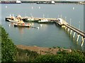
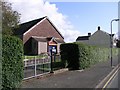
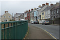
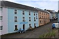
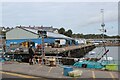
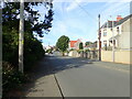
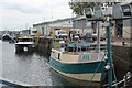
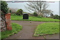
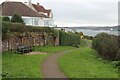
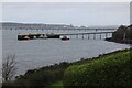
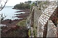
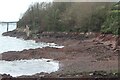
52 photos from this area
Area Information
Key information about the SA73 3EN including its size, population, and administrative classification.
- Area Type
- Postcode
- Area Size
- 7007 m²
- Population
- 1140
- Population Density
- 2744 people/km²
House Prices in SA73 3EN
19
Properties
£116,625
Average Sold Price
£66,500
Lowest Price
£225,000
Highest Price
Showing 19 properties
| Address | Type | Beds | Baths | Last Sale Price | Last Sale Date | |
|---|---|---|---|---|---|---|
| 63 Picton Road, Hakin, Milford Haven, SA73 3EN | house | 2 | 1 | £162,000 | Feb 2024 | |
| 3, St Clares Court, Picton Road, Hakin, Milford Haven, SA73 3EN | Detached | 3 | 1 | £225,000 | Jan 2023 | |
| 87 Picton Road, Hakin, Milford Haven, SA73 3EN | Terraced | 2 | 1 | £79,999 | Nov 2018 | |
| 79 Picton Road, Hakin, Milford Haven, SA73 3EN | Terraced | - | - | £66,500 | May 2016 | |
| 2, St Clares Court, Picton Road, Hakin, Milford Haven, SA73 3EN | house | - | - | £125,000 | Sep 2013 | |
| 71 Picton Road, Hakin, Milford Haven, SA73 3EN | Semi-detached | 2 | 1 | £71,000 | Oct 2012 | |
| 65 Picton Road, Hakin, Milford Haven, SA73 3EN | Semi-detached | - | - | £116,000 | Nov 2007 | |
| 1, St Clares Court, Picton Road, Hakin, Milford Haven, SA73 3EN | Detached | - | - | £87,500 | Jun 2003 | |
| 81 Picton Road, Hakin, Milford Haven, SA73 3EN | Terraced | - | - | - | - | |
| 83 Picton Road, Hakin, Milford Haven, SA73 3EN | Terraced | - | - | - | - |
Page 1 of 2
Energy Efficiency in SA73 3EN
Amenities
Schools
| Rank | School | Type | Entry gender | Ages |
|---|
Explore more schools in this area
Go to Schools tabDemographics
Household Size
Two person
most common
Accommodation Type
Houses
most common
Tenure
63
majority
Ethnic Group
White
most common
Religion
N/A
most common
Household Composition
N/A
most common
Age
47
median
Adults (30-64 years)
most common
Household Deprivation
N/A
with no deprivation
NS-SEC
28
in Lower managerial occupations
Explore more demographic insights in this area
Go to Demographics tabPlanning
Planning Constraints
- Flood RiskPremium
- Ramsar Wetland SitesPremium
- Area of Outstanding Natural BeautyPremium
- Protected Nature ReservePremium
- Protected WoodlandPremium
- Crime RiskPremium