Area Overview for SA73 2QH
Photos of SA73 2QH
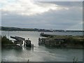

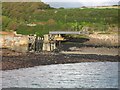
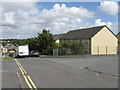
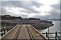
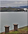
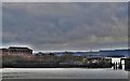
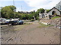
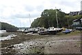
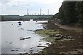
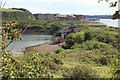
40 photos from this area
Area Information
Key information about the SA73 2QH including its size, population, and administrative classification.
- Area Type
- Postcode
- Area Size
- 19.8 hectares
- Population
- 2337
- Population Density
- 472 people/km²
House Prices in SA73 2QH
39
Properties
£79,966
Average Sold Price
£22,000
Lowest Price
£130,000
Highest Price
Showing 39 properties
| Address | Type | Beds | Baths | Last Sale Price | Last Sale Date | |
|---|---|---|---|---|---|---|
| 36 Vicary Crescent, Milford Haven, SA73 2QH | Semi-detached | 3 | 1 | £129,000 | Feb 2025 | |
| 24 Vicary Crescent, Milford Haven, SA73 2QH | Semi-detached | 3 | 1 | £130,000 | May 2024 | |
| 15 Vicary Crescent, Milford Haven, SA73 2QH | Semi-detached | 3 | 1 | £121,000 | Feb 2024 | |
| 27 Vicary Crescent, Milford Haven, SA73 2QH | house | - | - | £118,000 | Sep 2021 | |
| 28 Vicary Crescent, Milford Haven, SA73 2QH | Semi-detached | 3 | 2 | £100,000 | May 2021 | |
| 47 Vicary Crescent, Milford Haven, SA73 2QH | Semi-detached | 3 | 2 | £98,000 | Dec 2020 | |
| 49 Vicary Crescent, Milford Haven, SA73 2QH | Semi-detached | - | - | £77,000 | May 2020 | |
| 32 Vicary Crescent, Milford Haven, SA73 2QH | house | - | - | £65,000 | Feb 2013 | |
| 41 Vicary Crescent, Milford Haven, SA73 2QH | Semi-detached | - | - | £85,000 | Jul 2006 | |
| 48 Vicary Crescent, Milford Haven, SA73 2QH | Semi-detached | 3 | 1 | £89,500 | Sep 2005 |
Page 1 of 4
Energy Efficiency in SA73 2QH
Amenities
Schools
| Rank | School | Type | Entry gender | Ages |
|---|
Explore more schools in this area
Go to Schools tabDemographics
Household Size
One person
most common
Accommodation Type
Houses
most common
Tenure
52
majority
Ethnic Group
White
most common
Religion
N/A
most common
Household Composition
N/A
most common
Age
47
median
Adults (30-64 years)
most common
Household Deprivation
N/A
with no deprivation
NS-SEC
20
in Lower managerial occupations
Explore more demographic insights in this area
Go to Demographics tabPlanning
Planning Constraints
- Flood RiskPremium
- Ramsar Wetland SitesPremium
- Area of Outstanding Natural BeautyPremium
- Protected Nature ReservePremium
- Protected WoodlandPremium
- Crime RiskPremium