Area Overview for SA73 2NT
Photos of SA73 2NT
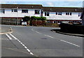
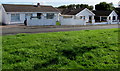

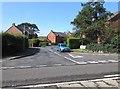
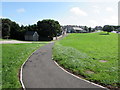
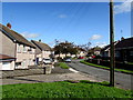
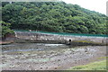
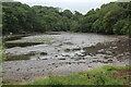
35 photos from this area
Area Information
Key information about the SA73 2NT including its size, population, and administrative classification.
- Area Type
- Postcode
- Area Size
- 1.0 hectares
- Population
- 2337
- Population Density
- 472 people/km²
House Prices in SA73 2NT
12
Properties
£107,056
Average Sold Price
£46,000
Lowest Price
£137,500
Highest Price
Showing 12 properties
| Address | Type | Beds | Baths | Last Sale Price | Last Sale Date | |
|---|---|---|---|---|---|---|
| 15 Coombs Drive, Milford Haven, SA73 2NT | Semi-detached | 3 | 1 | £129,999 | Oct 2022 | |
| 5 Coombs Drive, Milford Haven, SA73 2NT | Semi-detached | 3 | 1 | £137,500 | Jun 2022 | |
| 17 Coombs Drive, Milford Haven, SA73 2NT | Terraced | 3 | - | £124,950 | Jan 2021 | |
| 9 Coombs Drive, Milford Haven, SA73 2NT | Semi-detached | 3 | 1 | £120,000 | Dec 2020 | |
| 1 Coombs Drive, Milford Haven, SA73 2NT | house | 3 | - | £105,000 | Dec 2019 | |
| 11 Coombs Drive, Milford Haven, SA73 2NT | house | - | - | £68,500 | Mar 2014 | |
| 13 Coombs Drive, Milford Haven, SA73 2NT | house | - | - | £124,500 | May 2007 | |
| 7 Coombs Drive, Milford Haven, SA73 2NT | Semi-detached | - | - | £46,000 | Jul 2002 | |
| 3 Coombs Drive, Milford Haven, SA73 2NT | Semi-detached | 3 | 1 | - | - | |
| 23 Coombs Drive, Milford Haven, SA73 2NT | Semi-detached | - | - | - | - |
Page 1 of 2
Energy Efficiency in SA73 2NT
Amenities
Schools
| Rank | School | Type | Entry gender | Ages |
|---|
Explore more schools in this area
Go to Schools tabDemographics
Household Size
One person
most common
Accommodation Type
Houses
most common
Tenure
52
majority
Ethnic Group
White
most common
Religion
N/A
most common
Household Composition
N/A
most common
Age
47
median
Adults (30-64 years)
most common
Household Deprivation
N/A
with no deprivation
NS-SEC
20
in Lower managerial occupations
Explore more demographic insights in this area
Go to Demographics tabPlanning
Planning Constraints
- Flood RiskPremium
- Ramsar Wetland SitesPremium
- Area of Outstanding Natural BeautyPremium
- Protected Nature ReservePremium
- Protected WoodlandPremium
- Crime RiskPremium