Area Overview for SA73 1LW
Photos of SA73 1LW
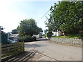
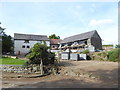
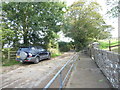
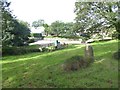
33 photos from this area
Area Information
Key information about the SA73 1LW including its size, population, and administrative classification.
- Area Type
- Postcode
- Area Size
- 8.9 hectares
- Population
- 1857
- Population Density
- 90 people/km²
House Prices in SA73 1LW
13
Properties
£468,889
Average Sold Price
£372,000
Lowest Price
£730,000
Highest Price
Showing 13 properties
| Address | Type | Beds | Baths | Last Sale Price | Last Sale Date | |
|---|---|---|---|---|---|---|
| Mallards, 9 Hawn Lake, Burton, Milford Haven, SA73 1LW | house | - | - | £730,000 | Aug 2021 | |
| Nevaeh, 5 Hawn Lake, Burton, Milford Haven, SA73 1LW | Detached | 5 | - | £488,000 | Feb 2021 | |
| 3 Hawn Lake, Burton, Milford Haven, SA73 1LW | Detached | 5 | 3 | £415,000 | Jun 2018 | |
| 12 Hawn Lake, Burton, Milford Haven, SA73 1LW | Detached | 5 | 3 | £460,000 | Jan 2018 | |
| 6 Hawn Lake, Burton, Milford Haven, SA73 1LW | Detached | 4 | 3 | £400,000 | Dec 2016 | |
| 4 Hawn Lake, Burton, Milford Haven, SA73 1LW | Detached | 5 | 3 | £450,000 | Apr 2015 | |
| Haven Mist, 2 Hawn Lake, Burton, Milford Haven, SA73 1LW | Detached | 5 | - | £372,000 | Sep 2014 | |
| 7 Hawn Lake, Burton, Milford Haven, SA73 1LW | house | 4 | - | £430,000 | Sep 2011 | |
| 8 Hawn Lake, Burton, Milford Haven, SA73 1LW | Detached | 5 | 4 | £475,000 | Nov 2006 | |
| Hawn House, 14 Hawn Lake, Burton, Milford Haven, SA73 1LW | Detached | 5 | 4 | - | - |
Page 1 of 2
Energy Efficiency in SA73 1LW
Amenities
Schools
| Rank | School | Type | Entry gender | Ages |
|---|
Explore more schools in this area
Go to Schools tabDemographics
Household Size
Two person
most common
Accommodation Type
Houses
most common
Tenure
85
majority
Ethnic Group
White
most common
Religion
N/A
most common
Household Composition
N/A
most common
Age
47
median
Adults (30-64 years)
most common
Household Deprivation
N/A
with no deprivation
NS-SEC
37
in Lower managerial occupations
Explore more demographic insights in this area
Go to Demographics tabPlanning
Planning Constraints
- Flood RiskPremium
- Ramsar Wetland SitesPremium
- Area of Outstanding Natural BeautyPremium
- Protected Nature ReservePremium
- Protected WoodlandPremium
- Crime RiskPremium