Area Overview for SA73 1LA
Photos of SA73 1LA

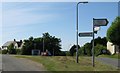


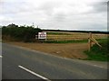


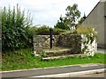
11 photos from this area
Area Information
Key information about the SA73 1LA including its size, population, and administrative classification.
- Area Type
- Postcode
- Area Size
- 16.7 hectares
- Population
- 1857
- Population Density
- 90 people/km²
House Prices in SA73 1LA
10
Properties
£278,333
Average Sold Price
£175,000
Lowest Price
£450,000
Highest Price
Showing 10 properties
| Address | Type | Beds | Baths | Last Sale Price | Last Sale Date | |
|---|---|---|---|---|---|---|
| Mulberry House, Thurston Lane, Sardis, Milford Haven, SA73 1LA | house | - | - | £450,000 | Jul 2021 | |
| Westwinds, Thurston Lane, Sardis, Milford Haven, SA73 1LA | Bungalow | 3 | 2 | £210,000 | Apr 2014 | |
| 3 Thurston Lane, Sardis, Milford Haven, SA73 1LA | Semi-detached | - | - | £175,000 | Aug 2006 | |
| The Croft, Thurston Lane, Sardis, Milford Haven, SA73 1LA | Bungalow | 2 | 1 | - | - | |
| Talar, 2 Thurston Lane, Sardis, Milford Haven, SA73 1LA | Land | - | - | - | - | |
| Hanging Stone, 5 Thurston Lane, Sardis, Milford Haven, SA73 1LA | Bungalow | - | - | - | - | |
| Stayley, 7 Thurston Lane, Sardis, Milford Haven, SA73 1LA | Detached | - | - | - | - | |
| Waterslade, 4 Thurston Lane, Sardis, Milford Haven, SA73 1LA | Semi-detached | - | - | - | - | |
| Salix, 6 Thurston Lane, Sardis, Milford Haven, SA73 1LA | Detached | - | - | - | - | |
| Caledon House, Thurston Lane, Sardis, Milford Haven, SA73 1LA | house | - | - | - | - |
Energy Efficiency in SA73 1LA
Amenities
Schools
| Rank | School | Type | Entry gender | Ages |
|---|
Explore more schools in this area
Go to Schools tabDemographics
Household Size
Two person
most common
Accommodation Type
Houses
most common
Tenure
85
majority
Ethnic Group
White
most common
Religion
N/A
most common
Household Composition
N/A
most common
Age
47
median
Adults (30-64 years)
most common
Household Deprivation
N/A
with no deprivation
NS-SEC
37
in Lower managerial occupations
Explore more demographic insights in this area
Go to Demographics tabPlanning
Planning Constraints
- Flood RiskPremium
- Ramsar Wetland SitesPremium
- Area of Outstanding Natural BeautyPremium
- Protected Nature ReservePremium
- Protected WoodlandPremium
- Crime RiskPremium