Area Overview for SA72 6AE
Photos of SA72 6AE
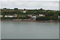
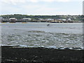
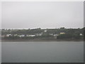
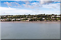
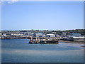
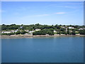
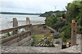
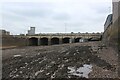
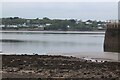
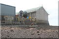
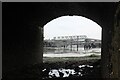
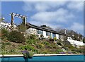
29 photos from this area
Area Information
Key information about the SA72 6AE including its size, population, and administrative classification.
- Area Type
- Postcode
- Area Size
- 48.7 hectares
- Population
- 1805
- Population Density
- 1460 people/km²
House Prices in SA72 6AE
11
Properties
-
Average Sold Price
-
Lowest Price
-
Highest Price
Showing 11 properties
| Address | Type | Beds | Baths | Last Sale Price | Last Sale Date | |
|---|---|---|---|---|---|---|
| Building 14, Pembroke Port Gate 4, Fort Road, Pembroke Dock, SA72 6AE | warehouse | - | - | - | - | |
| Building 21, Pembroke Port Gate 4, Fort Road, Pembroke Dock, SA72 6AE | warehouse | - | - | - | - | |
| Building 23, Pembroke Port Gate 4, Fort Road, Pembroke Dock, SA72 6AE | Office | - | - | - | - | |
| Mikota Ltd, Building 9, Pembroke Port Gate 4, Fort Road, Pembroke Dock, SA72 6AE | storage_distribution | - | - | - | - | |
| Milford Haven Port Authority, Building 22, Pembroke Port Gate 4, Fort Road, Pembroke Dock, SA72 6AE | Industrial | - | - | - | - | |
| Building 8A, Pembroke Port Gate 4, Fort Road, Pembroke Dock, SA72 6AE | warehouse | - | - | - | - | |
| Building 14A, Pembroke Port Gate 4, Fort Road, Pembroke Dock, SA72 6AE | warehouse | - | - | - | - | |
| Building 15, Pembroke Port Gate 4, Fort Road, Pembroke Dock, SA72 6AE | Office | - | - | - | - | |
| Building 27, Pembroke Port Gate 4, Fort Road, Pembroke Dock, SA72 6AE | storage_distribution | - | - | - | - | |
| Port Police, Pembroke Port Gate 4, Fort Road, Pembroke Dock, SA72 6AE | commercial | - | - | - | - |
Page 1 of 2
Energy Efficiency in SA72 6AE
Amenities
Schools
| Rank | School | Type | Entry gender | Ages |
|---|
Explore more schools in this area
Go to Schools tabDemographics
Household Size
One person
most common
Accommodation Type
Houses
most common
Tenure
62
majority
Ethnic Group
White
most common
Religion
N/A
most common
Household Composition
N/A
most common
Age
47
median
Adults (30-64 years)
most common
Household Deprivation
N/A
with no deprivation
NS-SEC
24
in Lower managerial occupations
Explore more demographic insights in this area
Go to Demographics tabPlanning
Planning Constraints
- Flood RiskPremium
- Ramsar Wetland SitesPremium
- Area of Outstanding Natural BeautyPremium
- Protected Nature ReservePremium
- Protected WoodlandPremium
- Crime RiskPremium