Area Overview for SA71 4LS
Photos of SA71 4LS
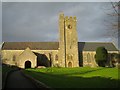
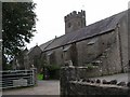
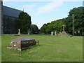
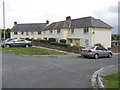
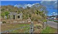
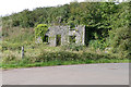
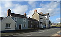
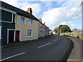
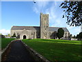
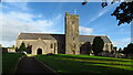
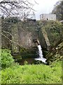
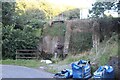
59 photos from this area
Area Information
Key information about the SA71 4LS including its size, population, and administrative classification.
- Area Type
- Postcode
- Area Size
- 9.0 hectares
- Population
- 1688
- Population Density
- 1227 people/km²
House Prices in SA71 4LS
48
Properties
£97,818
Average Sold Price
£23,750
Lowest Price
£225,000
Highest Price
Showing 48 properties
| Address | Type | Beds | Baths | Last Sale Price | Last Sale Date | |
|---|---|---|---|---|---|---|
| Verge's Cottage, 13 B 4320 Monkton Main Road, Monkton, Pembroke, SA71 4LS | Bungalow | - | - | £100,000 | Aug 2025 | |
| 79 B 4320 Monkton Main Road, Monkton, Pembroke, SA71 4LS | Terraced | 2 | 1 | £146,500 | May 2025 | |
| 43 B 4320 Monkton Main Road, Monkton, Pembroke, SA71 4LS | Terraced | 3 | 1 | £158,000 | Nov 2024 | |
| 47 B 4320 Monkton Main Road, Monkton, Pembroke, SA71 4LS | house | - | - | £158,000 | Nov 2024 | |
| 1, Police Houses, B 4320 Monkton Main Road, Monkton, Pembroke, SA71 4LS | house | - | - | £225,000 | Jun 2024 | |
| 23 B 4320 Monkton Main Road, Monkton, Pembroke, SA71 4LS | Terraced | 4 | 2 | £120,000 | Jan 2024 | |
| 69 B 4320 Monkton Main Road, Monkton, Pembroke, SA71 4LS | Terraced | 2 | 1 | £120,000 | Sep 2022 | |
| 3, Police Houses, B 4320 Monkton Main Road, Monkton, Pembroke, SA71 4LS | house | - | - | £145,000 | Dec 2020 | |
| 59 B 4320 Monkton Main Road, Monkton, Pembroke, SA71 4LS | Terraced | 4 | 1 | £154,000 | Dec 2017 | |
| Priory View Cottage, 31 B 4320 Monkton Main Road, Monkton, Pembroke, SA71 4LS | Cottage | 2 | 1 | £56,000 | Oct 2017 |
Page 1 of 5
Energy Efficiency in SA71 4LS
Amenities
Schools
| Rank | School | Type | Entry gender | Ages |
|---|
Explore more schools in this area
Go to Schools tabDemographics
Household Size
Family (3-5 people)
most common
Accommodation Type
Houses
most common
Tenure
39
majority
Ethnic Group
White
most common
Religion
N/A
most common
Household Composition
N/A
most common
Age
47
median
Adults (30-64 years)
most common
Household Deprivation
N/A
with no deprivation
NS-SEC
12
in Lower managerial occupations
Explore more demographic insights in this area
Go to Demographics tabPlanning
Planning Constraints
- Flood RiskPremium
- Ramsar Wetland SitesPremium
- Area of Outstanding Natural BeautyPremium
- Protected Nature ReservePremium
- Protected WoodlandPremium
- Crime RiskPremium