Area Overview for SA70 8RY
Photos of SA70 8RY
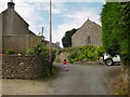


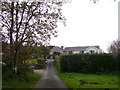
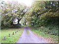
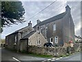
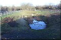
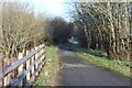
26 photos from this area
Area Information
Key information about the SA70 8RY including its size, population, and administrative classification.
- Area Type
- Postcode
- Area Size
- 22.9 hectares
- Population
- 1126
- Population Density
- 46 people/km²
House Prices in SA70 8RY
32
Properties
£187,308
Average Sold Price
£75,000
Lowest Price
£490,000
Highest Price
Showing 32 properties
| Address | Type | Beds | Baths | Last Sale Price | Last Sale Date | |
|---|---|---|---|---|---|---|
| 4 The Rise, Redberth, Tenby, SA70 8RY | Terraced | 3 | 1 | £188,000 | Nov 2023 | |
| Myrtle Cottage, U 6337 Redberth Church Road, Redberth, Tenby, SA70 8RY | Detached | 6 | 3 | £490,000 | Oct 2022 | |
| 8 The Rise, Redberth, Tenby, SA70 8RY | Semi-detached | 2 | 1 | £175,000 | Jul 2022 | |
| Yew Cottage, U 6337 Redberth Church Road, Redberth, Tenby, SA70 8RY | Bungalow | - | - | £430,000 | Jul 2022 | |
| Wesley Cottage, U 6337 Redberth Church Road, Redberth, Tenby, SA70 8RY | Detached | 2 | - | £134,500 | Jul 2021 | |
| The Old Barns, U 6337 Redberth Church Road, Redberth, Tenby, SA70 8RY | Detached | 3 | 3 | £188,500 | Dec 2017 | |
| 2 The Rise, Redberth, Tenby, SA70 8RY | Detached | 3 | 1 | £125,000 | Nov 2013 | |
| 7 The Rise, Redberth, Tenby, SA70 8RY | house | - | - | £110,000 | Jun 2013 | |
| 1 The Rise, Redberth, Tenby, SA70 8RY | house | 4 | 4 | £137,000 | Dec 2011 | |
| Sunnybank, U 6337 Redberth Church Road, Redberth, Tenby, SA70 8RY | house | - | - | £225,000 | Mar 2010 |
Page 1 of 4
Energy Efficiency in SA70 8RY
Amenities
Schools
| Rank | School | Type | Entry gender | Ages |
|---|
Explore more schools in this area
Go to Schools tabDemographics
Household Size
Two person
most common
Accommodation Type
Houses
most common
Tenure
80
majority
Ethnic Group
White
most common
Religion
N/A
most common
Household Composition
N/A
most common
Age
47
median
Adults (30-64 years)
most common
Household Deprivation
N/A
with no deprivation
NS-SEC
29
in Lower managerial occupations
Explore more demographic insights in this area
Go to Demographics tabPlanning
Planning Constraints
- Flood RiskPremium
- Ramsar Wetland SitesPremium
- Area of Outstanding Natural BeautyPremium
- Protected Nature ReservePremium
- Protected WoodlandPremium
- Crime RiskPremium