Area Overview for SA70 7TN
Photos of SA70 7TN
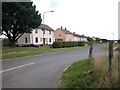
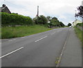
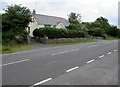
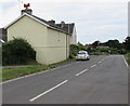
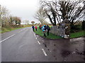
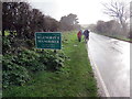
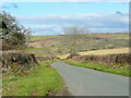
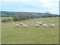
20 photos from this area
Area Information
Key information about the SA70 7TN including its size, population, and administrative classification.
- Area Type
- Postcode
- Area Size
- 25.4 hectares
- Population
- 2061
- Population Density
- 83 people/km²
House Prices in SA70 7TN
24
Properties
£329,214
Average Sold Price
£9,000
Lowest Price
£570,000
Highest Price
Showing 24 properties
| Address | Type | Beds | Baths | Last Sale Price | Last Sale Date | |
|---|---|---|---|---|---|---|
| The Hawthorns, B 4585 Manorbier To Junction A 4139, Manorbier, Tenby, SA70 7TN | Bungalow | - | - | £350,000 | Sep 2019 | |
| Willowyck, B 4585 Manorbier To Junction A 4139, Manorbier, Tenby, SA70 7TN | Bungalow | - | - | £9,000 | Jun 2017 | |
| Mill Croft, B 4585 Manorbier To Junction A 4139, Manorbier, Tenby, SA70 7TN | Bungalow | - | - | £273,000 | Nov 2016 | |
| Hillgarth, B 4585 Manorbier To Junction A 4139, Manorbier, Tenby, SA70 7TN | Detached | 6 | 4 | £570,000 | Apr 2016 | |
| Sunnybank, B 4585 Manorbier To Junction A 4139, Manorbier, Tenby, SA70 7TN | Bungalow | - | - | £322,500 | Apr 2013 | |
| The Firs, 4 Longfield, Manorbier, Tenby, SA70 7TN | Bungalow | 5 | - | £435,000 | Apr 2012 | |
| 3 Longfield, Manorbier, Tenby, SA70 7TN | Bungalow | - | - | £345,000 | May 2008 | |
| 5 Longfield, Manorbier, Tenby, SA70 7TN | Bungalow | 2 | 1 | - | - | |
| 3, The Croft, B 4585 Manorbier To Junction A 4139, Manorbier, Tenby, SA70 7TN | house | 3 | 1 | - | - | |
| 4, Seashells, The Croft, B 4585 Manorbier To Junction A 4139, Manorbier, Tenby, SA70 7TN | Terraced | 4 | 1 | - | - |
Page 1 of 3
Energy Efficiency in SA70 7TN
Amenities
Schools
| Rank | School | Type | Entry gender | Ages |
|---|
Explore more schools in this area
Go to Schools tabDemographics
Household Size
Two person
most common
Accommodation Type
Houses
most common
Tenure
71
majority
Ethnic Group
White
most common
Religion
N/A
most common
Household Composition
N/A
most common
Age
47
median
Adults (30-64 years)
most common
Household Deprivation
N/A
with no deprivation
NS-SEC
30
in Lower managerial occupations
Explore more demographic insights in this area
Go to Demographics tabPlanning
Planning Constraints
- Flood RiskPremium
- Ramsar Wetland SitesPremium
- Area of Outstanding Natural BeautyPremium
- Protected Nature ReservePremium
- Protected WoodlandPremium
- Crime RiskPremium