Area Overview for SA70 7PE
Photos of SA70 7PE
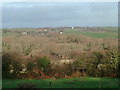
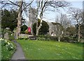
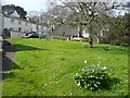
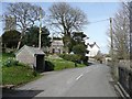
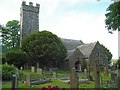
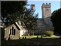
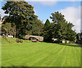
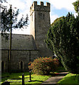

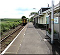
62 photos from this area
Area Information
Key information about the SA70 7PE including its size, population, and administrative classification.
- Area Type
- Postcode
- Area Size
- 4.2 hectares
- Population
- 1695
- Population Density
- 83 people/km²
House Prices in SA70 7PE
20
Properties
£220,969
Average Sold Price
£55,250
Lowest Price
£517,500
Highest Price
Showing 20 properties
| Address | Type | Beds | Baths | Last Sale Price | Last Sale Date | |
|---|---|---|---|---|---|---|
| Dolwen, C 3184 Penally Village Road, Penally, Tenby, SA70 7PE | Bungalow | 3 | 1 | £415,000 | Dec 2024 | |
| Orchard House, C 3184 Penally Village Road, Penally, Tenby, SA70 7PE | Detached | 4 | 2 | £517,500 | Aug 2024 | |
| Two Spires, C 3184 Penally Village Road, Penally, Tenby, SA70 7PE | Bungalow | 3 | - | £195,000 | Feb 2014 | |
| Greenhill, C 3184 Penally Village Road, Penally, Tenby, SA70 7PE | Bungalow | - | - | £225,000 | Aug 2010 | |
| Branina, C 3184 Penally Village Road, Penally, Tenby, SA70 7PE | Detached | - | - | £205,000 | Jun 2005 | |
| The Shieling, C 3184 Penally Village Road, Penally, Tenby, SA70 7PE | Detached | - | - | £80,000 | Jan 2001 | |
| Cressage, C 3184 Penally Village Road, Penally, Tenby, SA70 7PE | Detached | - | - | £75,000 | Oct 1995 | |
| Penn Lea, C 3184 Penally Village Road, Penally, Tenby, SA70 7PE | Detached | - | - | £55,250 | Jun 1995 | |
| The Summer House, C 3184 Penally Village Road, Penally, Tenby, SA70 7PE | Bungalow | 4 | 1 | - | - | |
| Lydway, C 3184 Penally Village Road, Penally, Tenby, SA70 7PE | Bungalow | 4 | 2 | - | - |
Page 1 of 2
Energy Efficiency in SA70 7PE
Amenities
Schools
| Rank | School | Type | Entry gender | Ages |
|---|
Explore more schools in this area
Go to Schools tabDemographics
Household Size
Two person
most common
Accommodation Type
Houses
most common
Tenure
79
majority
Ethnic Group
White
most common
Religion
N/A
most common
Household Composition
N/A
most common
Age
47
median
Adults (30-64 years)
most common
Household Deprivation
N/A
with no deprivation
NS-SEC
34
in Lower managerial occupations
Explore more demographic insights in this area
Go to Demographics tabPlanning
Planning Constraints
- Flood RiskPremium
- Ramsar Wetland SitesPremium
- Area of Outstanding Natural BeautyPremium
- Protected Nature ReservePremium
- Protected WoodlandPremium
- Crime RiskPremium