Area Overview for SA70 7LZ
Photos of SA70 7LZ


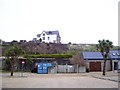
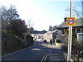

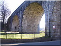
100 photos from this area
Area Information
Key information about the SA70 7LZ including its size, population, and administrative classification.
- Area Type
- Postcode
- Area Size
- 1273 m²
- Population
- 2095
- Population Density
- 533 people/km²
House Prices in SA70 7LZ
42
Properties
£103,943
Average Sold Price
£27,000
Lowest Price
£190,000
Highest Price
Showing 42 properties
| Address | Type | Beds | Baths | Last Sale Price | Last Sale Date | |
|---|---|---|---|---|---|---|
| 9, Clareston Court, Station Road, Tenby, SA70 7LZ | Flat | 2 | 1 | £130,000 | Jun 2025 | |
| 32, Clareston Court, Station Road, Tenby, SA70 7LZ | Flat | - | - | £140,000 | May 2025 | |
| 42, Clareston Court, Station Road, Tenby, SA70 7LZ | Flat | - | - | £190,000 | Dec 2024 | |
| 15, Clareston Court, Station Road, Tenby, SA70 7LZ | Flat | - | - | £140,000 | Dec 2024 | |
| 2, Clareston Court, Station Road, Tenby, SA70 7LZ | Flat | - | - | £125,000 | Jun 2024 | |
| 37, Clareston Court, Station Road, Tenby, SA70 7LZ | Flat | 2 | 1 | £150,000 | Aug 2022 | |
| 5, Clareston Court, Station Road, Tenby, SA70 7LZ | Flat | - | - | £129,950 | Aug 2022 | |
| 4, Clareston Court, Station Road, Tenby, SA70 7LZ | Flat | - | - | £169,000 | Feb 2022 | |
| 14, Clareston Court, Station Road, Tenby, SA70 7LZ | Flat | 2 | 1 | £110,000 | Dec 2021 | |
| 33 Clareston Court, Station Road, Tenby, SA70 7LZ | Flat | 2 | 1 | £126,500 | Feb 2021 |
Page 1 of 5
Energy Efficiency in SA70 7LZ
Amenities
Schools
| Rank | School | Type | Entry gender | Ages |
|---|
Explore more schools in this area
Go to Schools tabDemographics
Household Size
One person
most common
Accommodation Type
Houses
most common
Tenure
49
majority
Ethnic Group
White
most common
Religion
N/A
most common
Household Composition
N/A
most common
Age
47
median
Adults (30-64 years)
most common
Household Deprivation
N/A
with no deprivation
NS-SEC
26
in Lower managerial occupations
Explore more demographic insights in this area
Go to Demographics tabPlanning
Planning Constraints
- Flood RiskPremium
- Ramsar Wetland SitesPremium
- Area of Outstanding Natural BeautyPremium
- Protected Nature ReservePremium
- Protected WoodlandPremium
- Crime RiskPremium