Area Overview for SA69 9PG
Photos of SA69 9PG
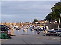
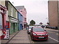
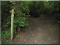
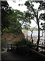
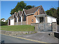
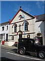
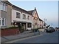
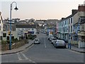
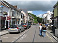
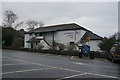
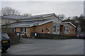
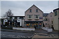
100 photos from this area
Area Information
Key information about the SA69 9PG including its size, population, and administrative classification.
- Area Type
- Postcode
- Area Size
- 2.6 hectares
- Population
- 2352
- Population Density
- 347 people/km²
House Prices in SA69 9PG
41
Properties
£223,193
Average Sold Price
£9,880
Lowest Price
£595,000
Highest Price
Showing 41 properties
| Address | Type | Beds | Baths | Last Sale Price | Last Sale Date | |
|---|---|---|---|---|---|---|
| 14 Bevelin Hall, Saundersfoot, SA69 9PG | Detached | 4 | 2 | £300,000 | Dec 2025 | |
| Peacehaven, 11 Bevelin Hall, Saundersfoot, SA69 9PG | Bungalow | 3 | 1 | £352,000 | Mar 2024 | |
| Seashores, 13 Bevelin Hall, Saundersfoot, SA69 9PG | Detached | 3 | 3 | £595,000 | May 2023 | |
| 4 Bevelin Hall, Saundersfoot, SA69 9PG | Detached | 4 | 3 | £530,000 | Feb 2022 | |
| 36 Bevelin Hall, Saundersfoot, SA69 9PG | Detached | - | - | £9,880 | Apr 2021 | |
| Indalo, 8 Bevelin Hall, Saundersfoot, SA69 9PG | Bungalow | 4 | 2 | £345,000 | Dec 2018 | |
| 42 Bevelin Hall, Saundersfoot, SA69 9PG | Detached | 3 | 1 | £254,000 | Feb 2018 | |
| Seaview, Bevelin Hall, Saundersfoot, SA69 9PG | Detached | 5 | 3 | £350,000 | Jul 2014 | |
| 39 Bevelin Hall, Saundersfoot, SA69 9PG | Detached | 4 | 3 | £240,000 | Apr 2014 | |
| 41 Bevelin Hall, Saundersfoot, SA69 9PG | Detached | 5 | 3 | £195,000 | Mar 2014 |
Page 1 of 5
Energy Efficiency in SA69 9PG
Amenities
Schools
| Rank | School | Type | Entry gender | Ages |
|---|
Explore more schools in this area
Go to Schools tabDemographics
Household Size
Two person
most common
Accommodation Type
Houses
most common
Tenure
70
majority
Ethnic Group
White
most common
Religion
N/A
most common
Household Composition
N/A
most common
Age
47
median
Adults (30-64 years)
most common
Household Deprivation
N/A
with no deprivation
NS-SEC
34
in Lower managerial occupations
Explore more demographic insights in this area
Go to Demographics tabPlanning
Planning Constraints
- Flood RiskPremium
- Ramsar Wetland SitesPremium
- Area of Outstanding Natural BeautyPremium
- Protected Nature ReservePremium
- Protected WoodlandPremium
- Crime RiskPremium