Area Overview for SA69 9NQ
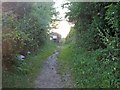
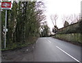
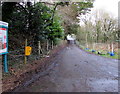
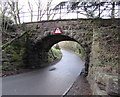
Photos of SA69 9NQ


Area Information
Living in SA69 9NQ offers a settled existence within a specific residential cluster in Wales. The area encompasses a population of 2,352 people, creating a compact community with a density of 347 people per square kilometre. This postcode functions as a small, focused environment rather than a sprawling district. Residents benefit from proximity to significant coastal features, including access to Caldey Island via the ferry. Daily life revolves around local convenience and access to transport links that connect the community to wider Pembrokeshire. The area possesses a distinct character defined by its house-based accommodation stock and a majority of home owners. You will find a neighbourhood where residents interact closely due to the limited dwelling count within this specific postal code. The location provides a quiet setting whilst maintaining reach to retail outlets and railway stations. It represents a slice of rural life that integrates easily with nearby towns like Saundersfoot and Tenby. This area suits those seeking a contained environment where boundaries are clear and community size is manageable.
- Area Type
- Postcode
- Area Size
- Not available
- Population
- 2352
- Population Density
- 347 people/km²
Homes in SA69 9NQ are characterised by a strong preference for ownership over renting. The property market here reflects a stock that is 70% owner-occupied, which is a significant majority for a residential cluster of this size. Accommodation types are exclusively houses, meaning you will not find flats or apartments within this specific postcode boundary. This homogeneity creates a consistent housing stock where buyers expect traditional properties rather than modern block living. The small population of 2,352 means competition for properties is generally localised within the immediate vicinity. Buyers looking at this area should prepare for a market where transactions involve owner-occupied sellers who have lived in the homes for years. The exclusive nature of house-based living appeals to families and those seeking gardens and space. Rental turnovers are minimal due to the high home ownership figure. If you are purchasing a home here, expect a market driven by local needs rather than speculative investment. The focus remains firmly on established domestic housing stock suitable for long-term settlement.
House Prices in SA69 9NQ
Showing 1 properties
| Address | Type | Beds | Baths | Last Sale Price | Last Sale Date | |
|---|---|---|---|---|---|---|
| Pembrokeshire Model Village, Valley Road, Saundersfoot, SA69 9NQ | Leisure | - | - | - | - |
Energy Efficiency in SA69 9NQ
Daily life in SA69 9NQ blends rural quietness with practical access to essential amenities within a short journey. Residents have five notable retail options nearby, including Tesco Saundersfoot, Spar, and the Co-op in Kilgetty. These shops provide for all basic shopping needs without the need to travel far. For those seeking leisure, two ferry services connect the area to Caldey Island and Tenby. The Tenby Ferry Landing and Caldey Island Ferry Landing sit within practical reach of SA69 9NQ, opening up coastal exploration for weekends and holidays. Five railway stations are also accessible for commuting or travel by rail, with Saundersfoot, Kilgetty, and Tenby Railway Station all readily available. This combination of rail and sea links makes the area reachable despite its rural setting. You can walk or drive quickly to the Co-op for groceries or catch a train to Tenby. The presence of these specific venues ensures that isolation is non-existent. Local life revolves around these calculated journeys rather than deep rural poverty of options. Amenities are clustered enough to support a comfortable and convenient existence for most households.
Amenities
Schools
Families residing in SA69 9NQ rely on a limited selection of educational institutions for their children's schooling. The nearest educational facilities include Saundersfoot C.P. School, which serves as a key option for the local community. Netherwood School also stands as another nearby provider for students from this postcode area. Both establishments are classified as other schools, indicating they do not hold the specific category of primary or secondary institutions in the data records. With a population of 2,352, the demand for school spaces is met by these two prominent local names. Parents in the area must look beyond this postcode boundary to find appropriate education, as the immediate cluster does not contain multiple options. The proximity of Saundersfoot and Netherwood ensures that walkable or short drive routes to education exist. You will not find comprehensive academies or specialism sixth form colleges directly within SA69 9NQ. The dependability of these two schools provides a foundation for family life in the region. Children in the area benefit from the established reputation of these named institutions in Pembrokeshire.
| Rank | School | Type | Entry gender | Ages |
|---|
Explore more schools in this area
Go to Schools tabDemographics
The community in SA69 9NQ displays a clear profile of middle-aged stability. The median age stands at 47 years, reflecting a neighbourhood dominated by adults aged between 30 and 64 years. This age distribution suggests a population focused on family life and established careers rather than transient young professionals or retirees. Accommodation types align with this demographic, comprising almost entirely houses rather than apartments or flats. Seventy per cent of homes are owner-occupied, indicating strong roots and long-term residence within this postcode. The population is predominantly White, mirroring the broader Welsh demographic trends found in coastal rural areas. You will not find significant ethnic diversity differences impacting daily life compared to larger urban centres. The high ownership rate of 70% creates a stable environment where decisions regarding property maintenance are permanent. This lack of rental pressure contributes to a quiet atmosphere where neighbours know one another well. The area feels like a permanent home for those who have chosen to settle in Pembrokeshire.
Household Size
Accommodation Type
Tenure
Ethnic Group
Religion
Household Composition
Age
Household Deprivation
NS-SEC
Explore more demographic insights in this area
Go to Demographics tabPlanning
Planning Constraints
- Flood RiskPremium
- Ramsar Wetland SitesPremium
- Area of Outstanding Natural BeautyPremium
- Protected Nature ReservePremium
- Protected WoodlandPremium
- Crime RiskPremium