Area Overview for SA69 9HH
Photos of SA69 9HH
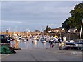
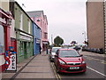
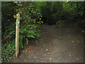
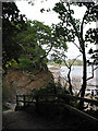
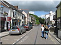
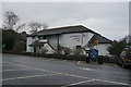

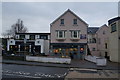
100 photos from this area
Area Information
Key information about the SA69 9HH including its size, population, and administrative classification.
- Area Type
- Postcode
- Area Size
- 1.8 hectares
- Population
- 2352
- Population Density
- 347 people/km²
House Prices in SA69 9HH
20
Properties
£381,333
Average Sold Price
£230,000
Lowest Price
£700,000
Highest Price
Showing 20 properties
| Address | Type | Beds | Baths | Last Sale Price | Last Sale Date | |
|---|---|---|---|---|---|---|
| Silver Sands, Stammers Road, Saundersfoot, SA69 9HH | Detached | 4 | 1 | £700,000 | Nov 2022 | |
| Lindy Villa, Stammers Road, Saundersfoot, SA69 9HH | Detached | 5 | 2 | £560,000 | Apr 2021 | |
| Jubilee Cottage, Stammers Road, Saundersfoot, SA69 9HH | Semi-detached | 3 | 1 | £243,000 | Jul 2018 | |
| White Gates, Stammers Road, Saundersfoot, SA69 9HH | Bungalow | 3 | - | £305,000 | Jul 2015 | |
| The Beaches, Stammers Road, Saundersfoot, SA69 9HH | house | - | - | £230,000 | Dec 2014 | |
| Primrose Cottage, Stammers Road, Saundersfoot, SA69 9HH | house | - | - | £250,000 | Nov 2011 | |
| 0 Stammers Road, Jubilee Guest House, Saundersfoot, SA69 9HH | Semi-detached | 7 | 2 | - | - | |
| Captiva Cottage, Stammers Road, Saundersfoot, SA69 9HH | Bungalow | 4 | 1 | - | - | |
| Shrublands, Stammers Road, Saundersfoot, SA69 9HH | Bungalow | 4 | 1 | - | - | |
| Caravan, Jubilee Guest House, Stammers Road, Saundersfoot, SA69 9HH | Mobile Home | - | - | - | - |
Page 1 of 2
Energy Efficiency in SA69 9HH
Amenities
Schools
| Rank | School | Type | Entry gender | Ages |
|---|
Explore more schools in this area
Go to Schools tabDemographics
Household Size
Two person
most common
Accommodation Type
Houses
most common
Tenure
70
majority
Ethnic Group
White
most common
Religion
N/A
most common
Household Composition
N/A
most common
Age
47
median
Adults (30-64 years)
most common
Household Deprivation
N/A
with no deprivation
NS-SEC
34
in Lower managerial occupations
Explore more demographic insights in this area
Go to Demographics tabPlanning
Planning Constraints
- Flood RiskPremium
- Ramsar Wetland SitesPremium
- Area of Outstanding Natural BeautyPremium
- Protected Nature ReservePremium
- Protected WoodlandPremium
- Crime RiskPremium