Area Overview for SA67 8PN
Photos of SA67 8PN


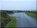
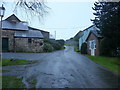


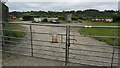


12 photos from this area
Area Information
Key information about the SA67 8PN including its size, population, and administrative classification.
- Area Type
- Postcode
- Area Size
- 15.2 hectares
- Population
- 1226
- Population Density
- 67 people/km²
House Prices in SA67 8PN
6
Properties
£168,500
Average Sold Price
£142,000
Lowest Price
£195,000
Highest Price
Showing 6 properties
| Address | Type | Beds | Baths | Last Sale Price | Last Sale Date | |
|---|---|---|---|---|---|---|
| The Cow Shed, C 3185 Junction A 477 T Penybont To Junction C 3014, Stepaside, SA67 8PN | Detached | 2 | 1 | £142,000 | Apr 2020 | |
| The Coach House, C 3185 Junction A 477 T Penybont To Junction C 3014, Stepaside, SA67 8PN | house | - | - | £195,000 | Mar 2003 | |
| Berry Hillock, C 3185 Junction A 477 T Penybont To Junction C 3014, Stepaside, SA67 8PN | Bungalow | 3 | 1 | - | - | |
| Swallows Nest, C 3185 Junction A 477 T Penybont To Junction C 3014, Stepaside, SA67 8PN | Detached | - | - | - | - | |
| Berry Lodge, C 3185 Junction A 477 T Penybont To Junction C 3014, Stepaside, SA67 8PN | Detached | - | - | - | - | |
| Caravan Site, Berry Hillock, C 3185 Junction A 477 T Penybont To Junction C 3014, Stepaside, SA67 8PN | Leisure | - | - | - | - |
Energy Efficiency in SA67 8PN
Amenities
Schools
| Rank | School | Type | Entry gender | Ages |
|---|
Explore more schools in this area
Go to Schools tabDemographics
Household Size
Two person
most common
Accommodation Type
Houses
most common
Tenure
81
majority
Ethnic Group
White
most common
Religion
N/A
most common
Household Composition
N/A
most common
Age
47
median
Adults (30-64 years)
most common
Household Deprivation
N/A
with no deprivation
NS-SEC
32
in Lower managerial occupations
Explore more demographic insights in this area
Go to Demographics tabPlanning
Planning Constraints
- Flood RiskPremium
- Ramsar Wetland SitesPremium
- Area of Outstanding Natural BeautyPremium
- Protected Nature ReservePremium
- Protected WoodlandPremium
- Crime RiskPremium