Area Overview for SA67 8NA
Photos of SA67 8NA
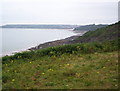
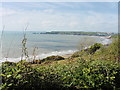
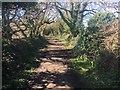
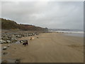
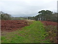
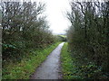
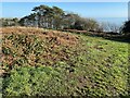
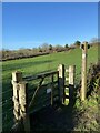
37 photos from this area
Area Information
Key information about the SA67 8NA including its size, population, and administrative classification.
- Area Type
- Postcode
- Area Size
- 31.2 hectares
- Population
- 1226
- Population Density
- 67 people/km²
House Prices in SA67 8NA
22
Properties
£413,750
Average Sold Price
£150,000
Lowest Price
£550,000
Highest Price
Showing 22 properties
| Address | Type | Beds | Baths | Last Sale Price | Last Sale Date | |
|---|---|---|---|---|---|---|
| Weather Oak, U 6365 Highlands Place, Amroth, Narberth, SA67 8NA | Bungalow | - | - | £285,000 | Mar 2025 | |
| Blue Horizons, U 6365 Highlands Place, Amroth, Narberth, SA67 8NA | Bungalow | - | - | £525,000 | May 2023 | |
| Katong, U 6365 Highlands Place, Amroth, Narberth, SA67 8NA | Detached | 5 | 2 | £550,000 | May 2022 | |
| Deep Meadows, U 6365 Highlands Place, Amroth, Narberth, SA67 8NA | Detached | 8 | 3 | £540,000 | Mar 2021 | |
| Himalaya, U 6365 Highlands Place, Amroth, Narberth, SA67 8NA | Bungalow | 5 | 2 | £455,000 | Sep 2018 | |
| Sound Of The Sea, U 6365 Highlands Place, Amroth, Narberth, SA67 8NA | Bungalow | - | - | £425,000 | Sep 2009 | |
| Penglyn, U 6365 Highlands Place, Amroth, Narberth, SA67 8NA | Detached | 3 | 2 | £380,000 | Dec 2006 | |
| Groveside, U 6365 Highlands Place, Amroth, Narberth, SA67 8NA | Detached | - | - | £150,000 | Nov 2003 | |
| Mellieha, U 6365 Highlands Place, Amroth, Narberth, SA67 8NA | Retail | 6 | 5 | - | - | |
| Sandpiper Cottage, U 6365 Highlands Place, Amroth, Narberth, SA67 8NA | Detached | 4 | 1 | - | - |
Page 1 of 3
Energy Efficiency in SA67 8NA
Amenities
Schools
| Rank | School | Type | Entry gender | Ages |
|---|
Explore more schools in this area
Go to Schools tabDemographics
Household Size
Two person
most common
Accommodation Type
Houses
most common
Tenure
81
majority
Ethnic Group
White
most common
Religion
N/A
most common
Household Composition
N/A
most common
Age
47
median
Adults (30-64 years)
most common
Household Deprivation
N/A
with no deprivation
NS-SEC
32
in Lower managerial occupations
Explore more demographic insights in this area
Go to Demographics tabPlanning
Planning Constraints
- Flood RiskPremium
- Ramsar Wetland SitesPremium
- Area of Outstanding Natural BeautyPremium
- Protected Nature ReservePremium
- Protected WoodlandPremium
- Crime RiskPremium