Area Overview for SA67 8LL
Photos of SA67 8LL

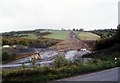

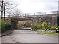
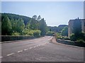
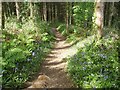
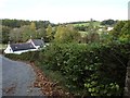
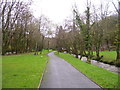
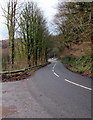
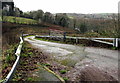
55 photos from this area
Area Information
Key information about the SA67 8LL including its size, population, and administrative classification.
- Area Type
- Postcode
- Area Size
- 4.7 hectares
- Population
- 1226
- Population Density
- 67 people/km²
House Prices in SA67 8LL
9
Properties
£378,667
Average Sold Price
£9,000
Lowest Price
£938,000
Highest Price
Showing 9 properties
| Address | Type | Beds | Baths | Last Sale Price | Last Sale Date | |
|---|---|---|---|---|---|---|
| Llwynon, U 6366 Pleasant Valley To Stepaside, Stepaside, SA67 8LL | Detached | 4 | 3 | £938,000 | Mar 2024 | |
| Wills End, U 6366 Pleasant Valley To Stepaside, Stepaside, SA67 8LL | Bungalow | 3 | - | £189,000 | May 2023 | |
| Little Boers, U 6366 Pleasant Valley To Stepaside, Stepaside, SA67 8LL | Bungalow | 3 | 3 | £9,000 | Mar 2022 | |
| 2, Brook Cottages, U 6366 Pleasant Valley To Stepaside, Stepaside, SA67 8LL | Terraced | 3 | 1 | - | - | |
| 3, Brook Cottages, U 6366 Pleasant Valley To Stepaside, Stepaside, SA67 8LL | Terraced | 3 | 1 | - | - | |
| Elrose Cottage, U 6366 Pleasant Valley To Stepaside, Stepaside, SA67 8LL | Detached | 3 | 2 | - | - | |
| Caravan, Wills End, U 6366 Pleasant Valley To Stepaside, Stepaside, SA67 8LL | Mobile Home | - | - | - | - | |
| 1, Brook Cottages, U 6366 Pleasant Valley To Stepaside, Stepaside, SA67 8LL | Terraced | - | - | - | - | |
| Ty Newydd, U 6366 Pleasant Valley To Stepaside, Stepaside, SA67 8LL | house | - | - | - | - |
Energy Efficiency in SA67 8LL
Amenities
Schools
| Rank | School | Type | Entry gender | Ages |
|---|
Explore more schools in this area
Go to Schools tabDemographics
Household Size
Two person
most common
Accommodation Type
Houses
most common
Tenure
81
majority
Ethnic Group
White
most common
Religion
N/A
most common
Household Composition
N/A
most common
Age
47
median
Adults (30-64 years)
most common
Household Deprivation
N/A
with no deprivation
NS-SEC
32
in Lower managerial occupations
Explore more demographic insights in this area
Go to Demographics tabPlanning
Planning Constraints
- Flood RiskPremium
- Ramsar Wetland SitesPremium
- Area of Outstanding Natural BeautyPremium
- Protected Nature ReservePremium
- Protected WoodlandPremium
- Crime RiskPremium