Area Overview for SA67 8HL
Photos of SA67 8HL

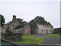
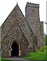
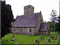
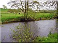
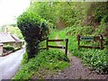
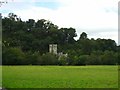
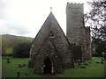
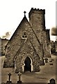
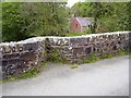
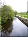
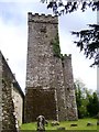
100 photos from this area
Area Information
Key information about the SA67 8HL including its size, population, and administrative classification.
- Area Type
- Postcode
- Area Size
- 22.6 hectares
- Population
- 1354
- Population Density
- 16 people/km²
House Prices in SA67 8HL
19
Properties
£261,500
Average Sold Price
£152,000
Lowest Price
£400,000
Highest Price
Showing 19 properties
| Address | Type | Beds | Baths | Last Sale Price | Last Sale Date | |
|---|---|---|---|---|---|---|
| Beltane, 0 , Llawhaden, Narberth, SA67 8HL | Bungalow | 6 | 3 | £330,000 | Nov 2024 | |
| Moat House, U 3096 Llawhaden Village, Llawhaden, Narberth, SA67 8HL | Detached | 3 | 2 | £300,000 | Nov 2023 | |
| Oaklands, U 3096 Llawhaden Village, Llawhaden, Narberth, SA67 8HL | Land | 4 | 1 | £315,000 | Jan 2017 | |
| Cloonmore, U 3096 Llawhaden Village, Llawhaden, Narberth, SA67 8HL | Bungalow | - | - | £240,000 | Jun 2013 | |
| Tanglost Cottage, U 3096 Llawhaden Village, Llawhaden, Narberth, SA67 8HL | Bungalow | - | - | £400,000 | Jul 2011 | |
| Green Acres, U 3096 Llawhaden Village, Llawhaden, Narberth, SA67 8HL | Bungalow | - | - | £200,000 | Apr 2011 | |
| Tymor Pedwar, U 3096 Llawhaden Village, Llawhaden, Narberth, SA67 8HL | Detached | - | - | £155,000 | Oct 2001 | |
| Southlands Cottage, U 3096 Llawhaden Village, Llawhaden, Narberth, SA67 8HL | Detached | - | - | £152,000 | Jul 2001 | |
| Vicarage, 0 , Llawhaden, Narberth, SA67 8HL | Bungalow | 5 | 2 | - | - | |
| Castle View Rest Home, U 3096 Llawhaden Village, Llawhaden, Narberth, SA67 8HL | Detached | 8 | 6 | - | - |
Page 1 of 2
Energy Efficiency in SA67 8HL
Amenities
Schools
| Rank | School | Type | Entry gender | Ages |
|---|
Explore more schools in this area
Go to Schools tabDemographics
Household Size
Two person
most common
Accommodation Type
Houses
most common
Tenure
74
majority
Ethnic Group
White
most common
Religion
N/A
most common
Household Composition
N/A
most common
Age
47
median
Adults (30-64 years)
most common
Household Deprivation
N/A
with no deprivation
NS-SEC
31
in Lower managerial occupations
Explore more demographic insights in this area
Go to Demographics tabPlanning
Planning Constraints
- Flood RiskPremium
- Ramsar Wetland SitesPremium
- Area of Outstanding Natural BeautyPremium
- Protected Nature ReservePremium
- Protected WoodlandPremium
- Crime RiskPremium