Area Overview for SA67 7BP
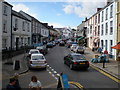
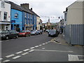
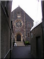
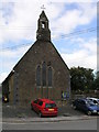
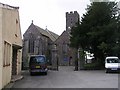
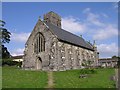
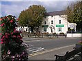
Photos of SA67 7BP

Area Information
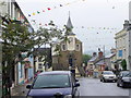
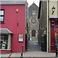
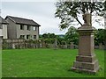
Living in SA67 7BP offers a quiet residential experience within a small cluster of homes in Wales. This specific postcode covers a population of 2,367 residents, creating a tight-knit environment where neighbours know one another. The area is defined by its scale and the steady rhythm of daily life that comes with such a focused community. You will find yourself surrounded by houses rather than high-rise blocks, which suits those seeking a traditional suburban feel. The location sits in a part of Wales that balances isolation with accessibility to nearby services. Daily life here involves navigating a neighbourhood where the housing stock is primarily single-family homes. Families and older residents form the core of the demographic, contributing to a stable atmosphere without the noise of heavy urban development. Because the area is small, it lacks the anonymity of a major city but gains a distinct character through local community ties. Prospective buyers who value a residential setting over commercial bustle will recognise this as the ideal type of location. The lack of large-scale planning constraints in the immediate vicinity supports this consistent residential character. Understanding the layout helps you visualise where you will be living. The concentration of homes means that local facilities are shared closely among residents. You do not deal with the complexities of a sprawling city district but rather the simplicity of a well-defined village extension. This postcode represents a slice of rural-urban transition in Wales, where peace of mind and manageable commute times take precedence. The environment remains consistent with the broader demands of living in the South Wales region while maintaining its own identity.
- Area Type
- Postcode
- Area Size
- Not available
- Population
- 2367
- Population Density
- 2683 people/km²
The housing market in SA67 7BP is characterised by a strong bias towards owner-occupation, with 60% of residents owning their homes. This statistic suggests a market where buyers have made a significant commitment to purchasing rather than renting. When looking at homes in this area, you are primarily viewing properties suited for families looking to settle down or empty-nesters down-sizing. The accommodation type is strictly houses, which means the market consists entirely of standalone or semi-detached dwellings. You will not find any flats or apartments listed as the predominant accommodation. This exclusivity of house types ensures that buyers seeking garden space and private outdoor areas will find exactly what they require. The absence of rental-heavy blocks indicates that the local economy and housing stock favour purchase commitments. This is particularly relevant if you are considering a buy-to-let investment, as the area lacks the high-density apartments common in city centres. For those buying in this small postcode, the competition may be lower than in larger towns due to the limited supply of specific properties. The housing stock remains consistent with the regional pattern for postcodes in this part of Wales. Prices and availability will reflect the demand from buyers who need a house rather than a flat. If you are buying for a family, the nearest shops are within a practical reach, proving the convenience of this specific market segment. The combination of high ownership rates and exclusive house types creates a straightforward marketplace for sensible buyers.
House Prices in SA67 7BP
No properties found in this postcode.
Energy Efficiency in SA67 7BP
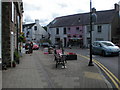
Your lifestyle in SA67 7BP revolves around convenience and everything you need within a short journey. The retail options available to you are accessible and include a Spar, alongside two Co-op supermarkets located in Kilgetty and Whitland. These three retail points ensure you can shop for groceries and household essentials without travelling too far. You do not need to drive into a city centre for your weekly shopping, which saves time and fuel. Transport connectivity further enhances your daily routine. Five railway stations serve the surrounding area, providing key access points such as Narberth Railway Station, Clunderwen Railway Station, and Kilgetty Railway Station. These stations offer regular services that connect you to wider regions. You can combine a quick walk or drive to the nearest shop with a train journey when necessary. The blend of local high street stores and rail access creates a balanced lifestyle that suits both commuters and those who prefer keeping things local. You have the best of both worlds in this specific postal district. The availability of these specific amenities means your day-to-day life flows smoothly. Whether you are picking up fresh produce at the Co-op or catching a train at Narberth, the infrastructure is there to support your routine. You find that the distance to these services is manageable for a typical household. This practical approach to amenities ensures you remain independent while enjoying the benefits of established local businesses. The presence of these named venues is exactly what defines the shopping landscape for anyone living here.
Amenities
Schools
Families considering schools near SA67 7BP have two main options within the immediate vicinity. The nearest educational institutions are Narberth CP School and Landsker Education. Both of these establishments are classified as 'other' type schools, indicating they may operate outside the standard state-of-the-training framework often associated with primary and secondary academies. The presence of these specific schools means you must verify their exact status and curriculum suitability if you have dependent children. You do not have a large comprehensive school immediately attached to this postcode, so you will rely on these local providers for initial education. The data lists only these two names, suggesting that you might need to look slightly further afield for primary or secondary options typically found in larger towns. When planning your route to schools, you should factor in the distances to Narberth CP School and Landsker Education. These are the only named educational facilities provided for this location. The 'other' classification requires you to check directly with the institutions to understand their entry requirements and specialisms. This mix reflects the rural nature of the area where households often share resources across a wider region. While the immediate area provides these specific learning environments, families must plan their commensurate journeys carefully to ensure access to full educational provision.
| Rank | School | Type | Entry gender | Ages |
|---|
Explore more schools in this area
Go to Schools tabDemographics
The community in SA67 7BP reflects a mature population structure with a median age of 47 years old. Most residents fall into the adult category, specifically those aged between 30 and 64 years. This demographic profile suggests a neighbourhood dominated by established households, working professionals, and retirees who have settled permanently in the region. You will encounter fewer young children living at home compared to more cosmopolitan areas, which impacts the local noise levels and general pace of life. Home ownership stands at a solid 60% level within this postcode. This figure indicates that two-thirds of the residents rely on mortgage-free living or have significant equity in their properties. Such a high rate of ownership typically correlates with community stability and long-term commitment to the area. The accommodation type is exclusively houses, meaning you will find detached, semi-detached, or terraced homes rather than apartments or flats. This aligns perfectly with the desire of many families to own their grounds and avoid the restrictions of leasehold agreements. Ethnically, the area is predominantly White, mirroring the broader demographic trends found across much of Wales and rural South Wales. The homogeneous nature of the population often leads to a familiar social landscape where cultural values are shared widely among neighbours. You do not need to navigate the complexities of a highly diverse urban centre here. Instead, the social fabric is woven from long-standing local traditions and family connections. This data paints a picture of a traditional Welsh community where values and lifestyles remain consistent across the houses.
Household Size
Accommodation Type
Tenure
Ethnic Group
Religion
Household Composition
Age
Household Deprivation
NS-SEC
Explore more demographic insights in this area
Go to Demographics tabPlanning
Planning Constraints
- Flood RiskPremium
- Ramsar Wetland SitesPremium
- Area of Outstanding Natural BeautyPremium
- Protected Nature ReservePremium
- Protected WoodlandPremium
- Crime RiskPremium