Area Overview for SA65 9PD
Photos of SA65 9PD
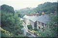
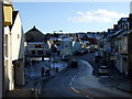

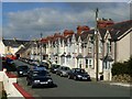
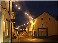
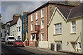
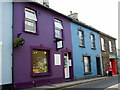
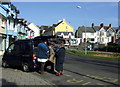
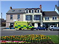
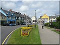
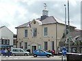
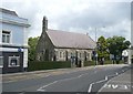
100 photos from this area
Area Information
Key information about the SA65 9PD including its size, population, and administrative classification.
- Area Type
- Postcode
- Area Size
- 4.4 hectares
- Population
- 1834
- Population Density
- 824 people/km²
House Prices in SA65 9PD
22
Properties
£142,244
Average Sold Price
£43,000
Lowest Price
£269,950
Highest Price
Showing 22 properties
| Address | Type | Beds | Baths | Last Sale Price | Last Sale Date | |
|---|---|---|---|---|---|---|
| 13 The Slade, Fishguard, SA65 9PD | Terraced | 3 | 2 | £269,950 | Aug 2024 | |
| Glenside, 0 The Slade, Fishguard, SA65 9PD | Detached | 5 | 3 | £197,500 | Jul 2020 | |
| 11 The Slade, Fishguard, SA65 9PD | Semi-detached | 5 | 3 | £125,000 | Mar 2015 | |
| 14 The Slade, Fishguard, SA65 9PD | Terraced | 3 | 1 | £129,000 | Jul 2013 | |
| 12 The Slade, Fishguard, SA65 9PD | Terraced | 3 | 1 | £132,000 | Oct 2012 | |
| 9 The Slade, Fishguard, SA65 9PD | Terraced | 3 | 1 | £129,000 | Sep 2010 | |
| 7 The Slade, Fishguard, SA65 9PD | house | - | - | £112,500 | May 2009 | |
| Rockburn, 10 The Slade, Fishguard, SA65 9PD | Terraced | - | - | £43,000 | Jul 1997 | |
| 8 The Slade, Fishguard, SA65 9PD | Semi-detached | 3 | 2 | - | - | |
| 17 THE SLADE, Fishguard, SA65 9PD | Detached | - | - | - | - |
Page 1 of 3
Energy Efficiency in SA65 9PD
Amenities
Schools
| Rank | School | Type | Entry gender | Ages |
|---|
Explore more schools in this area
Go to Schools tabDemographics
Household Size
One person
most common
Accommodation Type
Houses
most common
Tenure
69
majority
Ethnic Group
White
most common
Religion
N/A
most common
Household Composition
N/A
most common
Age
47
median
Adults (30-64 years)
most common
Household Deprivation
N/A
with no deprivation
NS-SEC
31
in Lower managerial occupations
Explore more demographic insights in this area
Go to Demographics tabPlanning
Planning Constraints
- Flood RiskPremium
- Ramsar Wetland SitesPremium
- Area of Outstanding Natural BeautyPremium
- Protected Nature ReservePremium
- Protected WoodlandPremium
- Crime RiskPremium