Area Overview for SA64 0HU
Photos of SA64 0HU
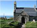
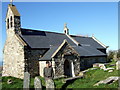
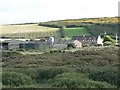

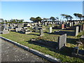
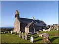
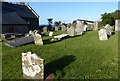
42 photos from this area
Area Information
Key information about the SA64 0HU including its size, population, and administrative classification.
- Area Type
- Postcode
- Area Size
- 38.1 hectares
- Population
- 1520
- Population Density
- 21 people/km²
House Prices in SA64 0HU
8
Properties
£366,625
Average Sold Price
£286,500
Lowest Price
£475,000
Highest Price
Showing 8 properties
| Address | Type | Beds | Baths | Last Sale Price | Last Sale Date | |
|---|---|---|---|---|---|---|
| Garn Gron, C 3103 Llanwnda To Junction Trefwrgi Road, Llanwnda, Goodwick, SA64 0HU | Bungalow | 2 | 1 | £286,500 | Mar 2019 | |
| Gwynfryn, C 3103 Llanwnda To Junction Trefwrgi Road, Llanwnda, Goodwick, SA64 0HU | Detached | 3 | 2 | £475,000 | Apr 2017 | |
| Glasfryn, U 3122 Junction C 3103 To Glasfryn, Llanwnda, Goodwick, SA64 0HU | Detached | 4 | 2 | £390,000 | Apr 2017 | |
| Garn Fach, C 3103 Llanwnda To Junction Trefwrgi Road, Llanwnda, Goodwick, SA64 0HU | Bungalow | - | - | £315,000 | Sep 2010 | |
| Gwynfryn Cottage, C 3103 Llanwnda To Junction Trefwrgi Road, Llanwnda, Goodwick, SA64 0HU | Bungalow | - | - | - | - | |
| Ymyl-y-graig, C 3103 Llanwnda To Junction Trefwrgi Road, Llanwnda, Goodwick, SA64 0HU | Detached | - | - | - | - | |
| 1, Garnwnda, U 3122 Junction C 3103 To Glasfryn, Llanwnda, Goodwick, SA64 0HU | Terraced | - | - | - | - | |
| New House, Garnwnda, U 3122 Junction C 3103 To Glasfryn, Llanwnda, Goodwick, SA64 0HU | Terraced | - | - | - | - |
Energy Efficiency in SA64 0HU
Amenities
Schools
| Rank | School | Type | Entry gender | Ages |
|---|
Explore more schools in this area
Go to Schools tabDemographics
Household Size
Two person
most common
Accommodation Type
Houses
most common
Tenure
68
majority
Ethnic Group
White
most common
Religion
N/A
most common
Household Composition
N/A
most common
Age
47
median
Adults (30-64 years)
most common
Household Deprivation
N/A
with no deprivation
NS-SEC
26
in Lower managerial occupations
Explore more demographic insights in this area
Go to Demographics tabPlanning
Planning Constraints
- Flood RiskPremium
- Ramsar Wetland SitesPremium
- Area of Outstanding Natural BeautyPremium
- Protected Nature ReservePremium
- Protected WoodlandPremium
- Crime RiskPremium