Area Overview for SA62 6SW
Photos of SA62 6SW
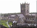
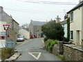
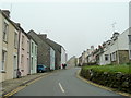
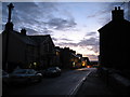
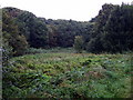
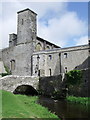
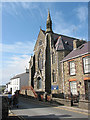
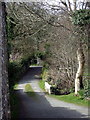
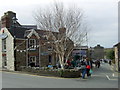
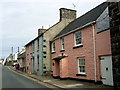
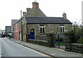
100 photos from this area
Area Information
Key information about the SA62 6SW including its size, population, and administrative classification.
- Area Type
- Postcode
- Area Size
- 1.6 hectares
- Population
- 1751
- Population Density
- 38 people/km²
House Prices in SA62 6SW
25
Properties
£277,818
Average Sold Price
£58,000
Lowest Price
£450,000
Highest Price
Showing 25 properties
| Address | Type | Beds | Baths | Last Sale Price | Last Sale Date | |
|---|---|---|---|---|---|---|
| 11 New Street, St Davids, SA62 6SW | Detached | 2 | 2 | £450,000 | Nov 2024 | |
| 21 New Street, St Davids, SA62 6SW | Terraced | 3 | 1 | £395,000 | Feb 2022 | |
| 19 New Street, St Davids, SA62 6SW | Terraced | 2 | 3 | £450,000 | Sep 2021 | |
| Aelybryn, 33 New Street, St Davids, SA62 6SW | house | 7 | 3 | £325,000 | Oct 2019 | |
| Willow Cottage, 35 New Street, St Davids, SA62 6SW | Semi-detached | 3 | 1 | £262,500 | Mar 2015 | |
| Ty Dewi, 67 New Street, St Davids, SA62 6SW | Bungalow | 3 | 1 | £240,000 | Jan 2013 | |
| Dwrgi Bach, 71 New Street, St Davids, SA62 6SW | Bungalow | - | - | £267,500 | Feb 2012 | |
| Bronllys, 23 New Street, St Davids, SA62 6SW | house | - | - | £200,000 | Mar 2011 | |
| O'r Diwedd, 37 New Street, St Davids, SA62 6SW | Detached | - | - | £280,000 | Oct 2007 | |
| Bryn Golau, 41 New Street, St Davids, SA62 6SW | Detached | - | - | £128,000 | Feb 2000 |
Page 1 of 3
Energy Efficiency in SA62 6SW
Amenities
Schools
| Rank | School | Type | Entry gender | Ages |
|---|
Explore more schools in this area
Go to Schools tabDemographics
Household Size
One person
most common
Accommodation Type
Houses
most common
Tenure
71
majority
Ethnic Group
White
most common
Religion
N/A
most common
Household Composition
N/A
most common
Age
47
median
Adults (30-64 years)
most common
Household Deprivation
N/A
with no deprivation
NS-SEC
33
in Lower managerial occupations
Explore more demographic insights in this area
Go to Demographics tabPlanning
Planning Constraints
- Flood RiskPremium
- Ramsar Wetland SitesPremium
- Area of Outstanding Natural BeautyPremium
- Protected Nature ReservePremium
- Protected WoodlandPremium
- Crime RiskPremium