Area Overview for SA62 6EP
Photos of SA62 6EP

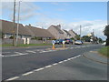
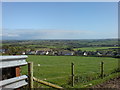
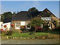

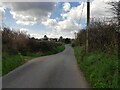

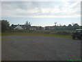
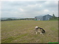
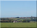
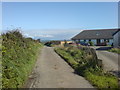
30 photos from this area
Area Information
Key information about the SA62 6EP including its size, population, and administrative classification.
- Area Type
- Postcode
- Area Size
- 10.5 hectares
- Population
- 1181
- Population Density
- 47 people/km²
House Prices in SA62 6EP
28
Properties
£191,211
Average Sold Price
£40,000
Lowest Price
£325,000
Highest Price
Showing 28 properties
| Address | Type | Beds | Baths | Last Sale Price | Last Sale Date | |
|---|---|---|---|---|---|---|
| Cornerways, A 487 Simpsons Cross Village, Simpson Cross, Haverfordwest, SA62 6EP | Detached | 4 | 1 | £305,000 | Mar 2025 | |
| Sunburst, 0 , Simpson Cross, Haverfordwest, SA62 6EP | Detached | 3 | 1 | £190,000 | Sep 2023 | |
| 6 Wayside Close, Simpson Cross, Haverfordwest, SA62 6EP | Flat | - | - | £100,000 | Feb 2023 | |
| Heather Glen, A 487 Simpsons Cross Village, Simpson Cross, Haverfordwest, SA62 6EP | Semi-detached | 4 | 1 | £225,000 | Feb 2023 | |
| Rhosgarnol, A 487 Simpsons Cross Village, Simpson Cross, Haverfordwest, SA62 6EP | Bungalow | 4 | - | £215,000 | Jul 2018 | |
| Forge Croft, Greenland Close, Simpson Cross, Haverfordwest, SA62 6EP | Bungalow | 4 | 1 | £325,000 | Dec 2017 | |
| Windyridge, 0 , Simpson Cross, Haverfordwest, SA62 6EP | Detached | 4 | 2 | £202,500 | Apr 2016 | |
| 1 Wayside Close, Simpson Cross, Haverfordwest, SA62 6EP | Bungalow | 4 | 2 | £97,500 | Apr 2015 | |
| 5 Wayside Close, Simpson Cross, Haverfordwest, SA62 6EP | Flat | - | - | £72,000 | Aug 2014 | |
| Mayfield, A 487 Simpsons Cross Village, Simpson Cross, Haverfordwest, SA62 6EP | Bungalow | - | - | £229,950 | Nov 2009 |
Page 1 of 3
Energy Efficiency in SA62 6EP
Amenities
Schools
| Rank | School | Type | Entry gender | Ages |
|---|
Explore more schools in this area
Go to Schools tabDemographics
Household Size
Two person
most common
Accommodation Type
Houses
most common
Tenure
81
majority
Ethnic Group
White
most common
Religion
N/A
most common
Household Composition
N/A
most common
Age
47
median
Adults (30-64 years)
most common
Household Deprivation
N/A
with no deprivation
NS-SEC
35
in Lower managerial occupations
Explore more demographic insights in this area
Go to Demographics tabPlanning
Planning Constraints
- Flood RiskPremium
- Ramsar Wetland SitesPremium
- Area of Outstanding Natural BeautyPremium
- Protected Nature ReservePremium
- Protected WoodlandPremium
- Crime RiskPremium