Area Overview for SA62 6BD
Photos of SA62 6BD
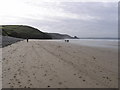
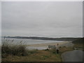
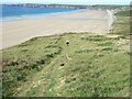
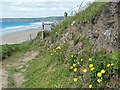
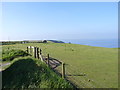
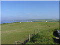
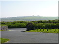
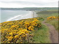
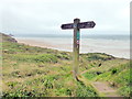
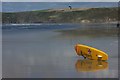
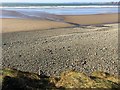
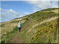
96 photos from this area
Area Information
Key information about the SA62 6BD including its size, population, and administrative classification.
- Area Type
- Postcode
- Area Size
- 2.8 km²
- Population
- 1181
- Population Density
- 47 people/km²
House Prices in SA62 6BD
8
Properties
£300,000
Average Sold Price
£300,000
Lowest Price
£300,000
Highest Price
Showing 8 properties
| Address | Type | Beds | Baths | Last Sale Price | Last Sale Date | |
|---|---|---|---|---|---|---|
| Chapel Farm, Welsh Road Spur To Chapel, Newgale, Haverfordwest, SA62 6BD | Detached | - | - | £300,000 | Dec 2020 | |
| Site Managers House, Newgale Coast Holiday Park, C 3028 Welsh Road To Newgale, Haverfordwest, SA62 6BD | Mobile Home | 2 | 2 | - | - | |
| Cedar Bungalow, Chapel Farm, Welsh Road Spur To Chapel, Newgale, Haverfordwest, SA62 6BD | Bungalow | 3 | - | - | - | |
| Chapel Farm Shop, Welsh Road Spur To Chapel, Newgale, Haverfordwest, SA62 6BD | shop | - | - | - | - | |
| The Cliff, C 3028 Welsh Road To Newgale, Haverfordwest, SA62 6BD | Detached | - | - | - | - | |
| Newgale Coast Holiday Park, C 3028 Welsh Road To Newgale, Haverfordwest, SA62 6BD | Leisure | - | - | - | - | |
| Lifeguard Station, C 3028 Welsh Road To Newgale, Haverfordwest, SA62 6BD | commercial | - | - | - | - | |
| 141, Newgale Beach Holiday Park, C 3028 Welsh Road To Newgale, Haverfordwest, SA62 6BD | Mobile Home | - | - | - | - |
Energy Efficiency in SA62 6BD
Amenities
Schools
| Rank | School | Type | Entry gender | Ages |
|---|
Explore more schools in this area
Go to Schools tabDemographics
Household Size
Two person
most common
Accommodation Type
Houses
most common
Tenure
81
majority
Ethnic Group
White
most common
Religion
N/A
most common
Household Composition
N/A
most common
Age
47
median
Adults (30-64 years)
most common
Household Deprivation
N/A
with no deprivation
NS-SEC
35
in Lower managerial occupations
Explore more demographic insights in this area
Go to Demographics tabPlanning
Planning Constraints
- Flood RiskPremium
- Ramsar Wetland SitesPremium
- Area of Outstanding Natural BeautyPremium
- Protected Nature ReservePremium
- Protected WoodlandPremium
- Crime RiskPremium