Area Overview for SA62 4HP
Photos of SA62 4HP
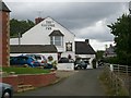
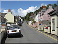
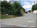
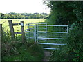
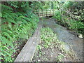
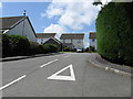
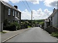
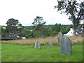
9 photos from this area
Area Information
Key information about the SA62 4HP including its size, population, and administrative classification.
- Area Type
- Postcode
- Area Size
- 2.9 hectares
- Population
- 2311
- Population Density
- 157 people/km²
House Prices in SA62 4HP
35
Properties
£158,845
Average Sold Price
£29,000
Lowest Price
£375,000
Highest Price
Showing 35 properties
| Address | Type | Beds | Baths | Last Sale Price | Last Sale Date | |
|---|---|---|---|---|---|---|
| Brick House, 30 Main Street, Llangwm, SA62 4HP | Detached | 2 | 2 | £220,000 | Oct 2025 | |
| Elm Cottage, 26 Main Street, Llangwm, SA62 4HP | Terraced | 2 | 1 | £140,000 | Sep 2025 | |
| Honey Cottage, 18 Main Street, Llangwm, SA62 4HP | Terraced | 2 | 1 | £160,000 | Mar 2024 | |
| Sycamore House, 16 Main Street, Llangwm, SA62 4HP | Cottage | 3 | 1 | £225,000 | Mar 2024 | |
| 5 Main Street, Llangwm, SA62 4HP | Semi-detached | 4 | 1 | £340,000 | Dec 2023 | |
| 17 Main Street, Llangwm, Haverfordwest, SA62 4HP | Detached | 2 | 1 | £250,000 | Nov 2023 | |
| Rose Cottage, 33 Main Street, Llangwm, SA62 4HP | Cottage | 3 | 1 | £150,100 | Oct 2022 | |
| 25 Main Street, Llangwm, SA62 4HP | Semi-detached | 3 | 2 | £375,000 | Mar 2022 | |
| Claremont, 9 Main Street, Llangwm, SA62 4HP | Semi-detached | 4 | 2 | £210,000 | Aug 2020 | |
| Renthorn Cottage, 12 Main Street, Llangwm, SA62 4HP | house | 3 | 1 | £155,000 | Dec 2019 |
Page 1 of 4
Energy Efficiency in SA62 4HP
Amenities
Schools
| Rank | School | Type | Entry gender | Ages |
|---|
Explore more schools in this area
Go to Schools tabDemographics
Household Size
Two person
most common
Accommodation Type
Houses
most common
Tenure
82
majority
Ethnic Group
White
most common
Religion
N/A
most common
Household Composition
N/A
most common
Age
47
median
Adults (30-64 years)
most common
Household Deprivation
N/A
with no deprivation
NS-SEC
37
in Lower managerial occupations
Explore more demographic insights in this area
Go to Demographics tabPlanning
Planning Constraints
- Flood RiskPremium
- Ramsar Wetland SitesPremium
- Area of Outstanding Natural BeautyPremium
- Protected Nature ReservePremium
- Protected WoodlandPremium
- Crime RiskPremium