Area Overview for SA62 4EQ
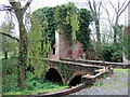
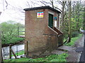
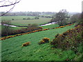
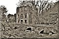
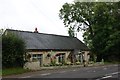
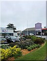
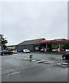
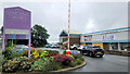
Photos of SA62 4EQ


Area Information
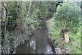
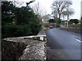
Living in SA62 4EQ means occupying a spot within a tightly knit residential cluster covering just 4.5 hectares. This postcode holds 2,108 residents, creating a focused environment where the community is close to home. The area sits firmly in rural Wales, offering a distinct break from the urban sprawl found elsewhere. Because the population density is relatively low at 60 people per square kilometre, you experience a quiet pace of life without the inevitable congestion of city centres. Daily life here revolves around local amenities in Haverfordwest, which are within practical reach. You are close enough to Munsters House and the Haverfordwest Railway Station for accessibility, yet far enough away to enjoy the peace that characterises the region. This small geographic footprint means neighbours are likely within walking distance, fostering a familiar streetscape. The area does not boast extensive green belt statistics or major industrial zones directly on the doorstep, but it provides a solid residential foundation. Prospective buyers will find that SA62 4EQ offers a specific slice of Welsh life where housing is predominantly owned rather than rented, suggesting stability in the local estate.
- Area Type
- Postcode
- Area Size
- 4.5 hectares
- Population
- 2108
- Population Density
- 60 people/km²
The property market in SA62 4EQ is distinctly owner-occupied. With 82% of homes owned outright, the area functions as a retirement or established family zone rather than a student or young professional rental hub. The accommodation type is strictly houses, removing any option for flat living. This concentration suggests a market driven by sales rather than short-term tenancies. Buyers looking at SA62 4EQ should expect to encounter a wide variety of house types, from early 20th-century homes to more recent builds, though the data confirms the dominance of the house form over flats. The high ownership rate implies that many properties have stayed in the same family for decades, often resulting in well-maintained exteriors and gardens. You are likely dealing with two previous owners for any given property in this postcode before it reaches the market. This stability often correlates with lower buyer turnover. The market does not cater to luxury flats or penthouses, focusing entirely on ground-level and first-floor residential units. Consequently, the price range will reflect the realities of rural Welsh housing, generally excluding the premiums associated with city-centre apartments.
House Prices in SA62 4EQ
Showing 1 properties
| Address | Type | Beds | Baths | Last Sale Price | Last Sale Date | |
|---|---|---|---|---|---|---|
| Western Power Distribution, Fishguard Road Industrial Estate, Haverfordwest, SA62 4EQ | Office | - | - | - | - |
Energy Efficiency in SA62 4EQ
Your lifestyle in SA62 4EQ is anchored by practical amenities in the nearby town of Haverfordwest. Five major retail outlets lie within practical reach, ensuring your daily shopping needs are met efficiently. You can visit M&S Haverfordwest for high street fashion and groceries, keeping the latest brands at the door. Morrisons Haverfordwest provides a weekly shop with fresh produce, which is convenient for home cooking. Aldi Haverfordwest offers budget-friendly alternatives if you plan your finances carefully. Beyond shopping, three railway stations facilitate daily commutes or weekend getaways, giving you access to the rest of the country. Haverfordwest Railway Station serves as the primary hub, supported by Clarbeston Road Railway Station and Johnston Railway Station for local variation. For those preferring air travel or quick trips, Haverfordwest Airport is located nearby. This mix of retail giants and transport nodes creates a self-contained lifestyle. You do not need to travel far for essentials, yet the transport links ensure the world remains accessible. The area balances local convenience with national connectivity.
Amenities
Schools
You have access to one primary educational institution nearby, Ysgol Caer Elen. This is the singular school name appearing in the local vicinity of SA62 4EQ. The catalogue lists this establishment as of the "other" type classification, distinguishing it from the standard primary or secondary categories often seen in larger urban datasets. For families residing in this 4.5-hectare cluster, Ysgol Caer Elen represents the main educational option. The presence of just one listed school suggests that residents may need to look slightly further afield for secondary education or that this specific facility serves a broad catchment area. The lack of multiple named institutions indicates a small-town dynamic where education is centralised rather than spread across a district of competing academies. Homebuyers should note that the data does not further classify the school into infant or junior sections, only marking it generally as "other". This single anchor point means community events often centre around this location. It is a solitary presence in an area defined by residential density rather than educational diversity.
| Rank | School | Type | Entry gender | Ages |
|---|
Explore more schools in this area
Go to Schools tabDemographics
The community in SA62 4EQ is defined by its mature inhabitants. The median age is 47 years, indicating a population skewed significantly towards older adults rather than young families or students. The most common age range falls between 30 and 64 years, which suggests a workforce capable of supporting the local economy but not necessarily raising large numbers of young children. Home ownership stands high at 82%, a figure that shapes the character of the streets. This statistic confirms that the vast majority of residents have purchased their homes, leading to long-term stability rather than a transient rental market. The accommodation type is exclusively houses, meaning you will not find flats or apartments within this specific cluster. There is a clear preference for detached or semi-detached dwellings over urban-style living. While the predominant ethnic group is White, the low population density allows for individual households to define their own immediate surroundings without significant diversity pressure. This demographic profile creates a neighbourhood where residents share similar life stages and financial commitments to property ownership.
Household Size
Accommodation Type
Tenure
Ethnic Group
Religion
Household Composition
Age
Household Deprivation
NS-SEC
Explore more demographic insights in this area
Go to Demographics tabPlanning
Planning Constraints
- Flood RiskPremium
- Ramsar Wetland SitesPremium
- Area of Outstanding Natural BeautyPremium
- Protected Nature ReservePremium
- Protected WoodlandPremium
- Crime RiskPremium