Area Overview for SA62 3JU
Photos of SA62 3JU
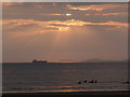
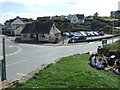
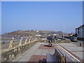
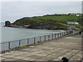
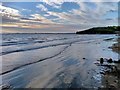
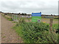
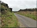
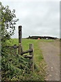
53 photos from this area
Area Information
Key information about the SA62 3JU including its size, population, and administrative classification.
- Area Type
- Postcode
- Area Size
- 3.3 hectares
- Population
- 1410
- Population Density
- 33 people/km²
House Prices in SA62 3JU
16
Properties
£222,889
Average Sold Price
£150,000
Lowest Price
£300,000
Highest Price
Showing 16 properties
| Address | Type | Beds | Baths | Last Sale Price | Last Sale Date | |
|---|---|---|---|---|---|---|
| Honeysuckle Cottage, Trafalgar Terrace, Broad Haven, SA62 3JU | Cottage | 2 | 1 | £235,000 | Aug 2025 | |
| 14 Trafalgar Terrace, Broad Haven, SA62 3JU | Terraced | 3 | 1 | £300,000 | Jul 2025 | |
| Bluebell Cottage, Trafalgar Terrace, Broad Haven, SA62 3JU | Terraced | 2 | 1 | £230,000 | Jun 2023 | |
| Pencoed, Trafalgar Terrace, Broad Haven, SA62 3JU | Bungalow | 2 | 1 | £215,000 | Aug 2021 | |
| 8 Trafalgar Terrace, Broad Haven, SA62 3JU | Terraced | 3 | 1 | £290,000 | Jan 2020 | |
| Foxglove Cottage, Trafalgar Terrace, Broad Haven, SA62 3JU | Terraced | 2 | 1 | £150,000 | May 2018 | |
| Snowdrop Cottage, Trafalgar Terrace, Broad Haven, SA62 3JU | Cottage | 2 | 1 | £186,000 | Aug 2012 | |
| 4 Trafalgar Terrace, Broad Haven, SA62 3JU | Terraced | - | - | £200,000 | Nov 2006 | |
| 12 Trafalgar Terrace, Broad Haven, SA62 3JU | Detached | - | - | £200,000 | May 2006 | |
| The Penthouse, The Royal Hotel, Trafalgar Terrace, Broad Haven, SA62 3JU | Land | 12 | 6 | - | - |
Page 1 of 2
Energy Efficiency in SA62 3JU
Amenities
Schools
| Rank | School | Type | Entry gender | Ages |
|---|
Explore more schools in this area
Go to Schools tabDemographics
Household Size
Two person
most common
Accommodation Type
Houses
most common
Tenure
79
majority
Ethnic Group
White
most common
Religion
N/A
most common
Household Composition
N/A
most common
Age
47
median
Adults (30-64 years)
most common
Household Deprivation
N/A
with no deprivation
NS-SEC
37
in Lower managerial occupations
Explore more demographic insights in this area
Go to Demographics tabPlanning
Planning Constraints
- Flood RiskPremium
- Ramsar Wetland SitesPremium
- Area of Outstanding Natural BeautyPremium
- Protected Nature ReservePremium
- Protected WoodlandPremium
- Crime RiskPremium