Area Overview for SA61 2UR
Photos of SA61 2UR
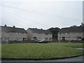
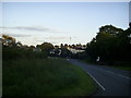
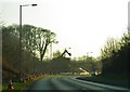
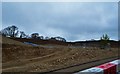
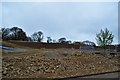
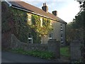

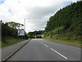
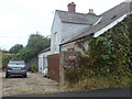
10 photos from this area
Area Information
Key information about the SA61 2UR including its size, population, and administrative classification.
- Area Type
- Postcode
- Area Size
- 1.1 km²
- Population
- 1104
- Population Density
- 694 people/km²
House Prices in SA61 2UR
28
Properties
£139,556
Average Sold Price
£60,000
Lowest Price
£212,000
Highest Price
Showing 28 properties
| Address | Type | Beds | Baths | Last Sale Price | Last Sale Date | |
|---|---|---|---|---|---|---|
| 4 Slade Villas, 0 St. Davids Road, Haverfordwest, SA61 2UR | Semi-detached | 3 | 1 | £175,000 | Mar 2023 | |
| Saludos, 0 St. Davids Road, Haverfordwest, SA61 2UR | Detached | 3 | 2 | £212,000 | May 2019 | |
| 7, Slade Villas, Slade Lane, Haverfordwest, SA61 2UR | Detached | 3 | 2 | £131,000 | Nov 2017 | |
| Loo Choo, St Davids Road, Haverfordwest, SA61 2UR | Detached | 4 | 2 | £175,000 | Apr 2017 | |
| Hunt Cottage, St Davids Road, Haverfordwest, SA61 2UR | Bungalow | 3 | 1 | £120,000 | May 2015 | |
| Bryn Teg, St Davids Road, Haverfordwest, SA61 2UR | house | 3 | - | £175,000 | Oct 2011 | |
| Clydfan, Slade Lane, Haverfordwest, SA61 2UR | Detached | - | - | £135,000 | Feb 2003 | |
| 1, Slade Villas, Slade Lane, Haverfordwest, SA61 2UR | Terraced | - | - | £60,000 | Mar 2001 | |
| Sundale, St Davids Road, Haverfordwest, SA61 2UR | Bungalow | 3 | - | £73,000 | Oct 2000 | |
| Arfryn, St Davids Road, Haverfordwest, SA61 2UR | Detached | 5 | 2 | - | - |
Page 1 of 3
Energy Efficiency in SA61 2UR
Amenities
Schools
| Rank | School | Type | Entry gender | Ages |
|---|
Explore more schools in this area
Go to Schools tabDemographics
Household Size
Two person
most common
Accommodation Type
Houses
most common
Tenure
51
majority
Ethnic Group
White
most common
Religion
N/A
most common
Household Composition
N/A
most common
Age
47
median
Adults (30-64 years)
most common
Household Deprivation
N/A
with no deprivation
NS-SEC
30
in Lower managerial occupations
Explore more demographic insights in this area
Go to Demographics tabPlanning
Planning Constraints
- Flood RiskPremium
- Ramsar Wetland SitesPremium
- Area of Outstanding Natural BeautyPremium
- Protected Nature ReservePremium
- Protected WoodlandPremium
- Crime RiskPremium