Area Overview for SA61 1LN
Photos of SA61 1LN
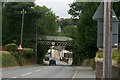
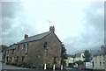
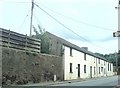
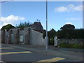
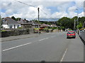
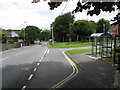
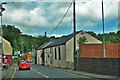
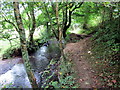
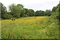
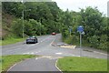
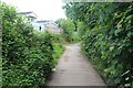
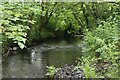
37 photos from this area
Area Information
Key information about the SA61 1LN including its size, population, and administrative classification.
- Area Type
- Postcode
- Area Size
- 1.5 hectares
- Population
- 2221
- Population Density
- 329 people/km²
House Prices in SA61 1LN
24
Properties
£177,893
Average Sold Price
£76,500
Lowest Price
£270,000
Highest Price
Showing 24 properties
| Address | Type | Beds | Baths | Last Sale Price | Last Sale Date | |
|---|---|---|---|---|---|---|
| 95 Pembroke Road, Haverfordwest, SA61 1LN | Semi-detached | 3 | 1 | £230,000 | Sep 2024 | |
| The Rowans, 99 Pembroke Road, Haverfordwest, SA61 1LN | Semi-detached | 2 | 1 | £166,000 | Sep 2023 | |
| Cherry Trees, 97 Pembroke Road, Haverfordwest, SA61 1LN | Semi-detached | 3 | 1 | £227,000 | Jun 2023 | |
| Alamy, 73 Pembroke Road, Haverfordwest, SA61 1LN | Semi-detached | 2 | 1 | £198,500 | Sep 2021 | |
| 91 Pembroke Road, Haverfordwest, SA61 1LN | Detached | 4 | 1 | £270,000 | May 2021 | |
| 57 Pembroke Road, Haverfordwest, SA61 1LN | Detached | 4 | 2 | £220,000 | Apr 2021 | |
| Police House, 59 Pembroke Road, Haverfordwest, SA61 1LN | Semi-detached | 3 | 1 | £164,000 | Nov 2018 | |
| 93 Pembroke Road, Haverfordwest, SA61 1LN | Semi-detached | 2 | 1 | £155,000 | Nov 2018 | |
| 55 Pembroke Road, Haverfordwest, SA61 1LN | Bungalow | 5 | - | £190,000 | Nov 2017 | |
| Southwood, 75 Pembroke Road, Haverfordwest, SA61 1LN | Semi-detached | 2 | 1 | £135,000 | Oct 2013 |
Page 1 of 3
Energy Efficiency in SA61 1LN
Amenities
Schools
| Rank | School | Type | Entry gender | Ages |
|---|
Explore more schools in this area
Go to Schools tabDemographics
Household Size
Two person
most common
Accommodation Type
Houses
most common
Tenure
57
majority
Ethnic Group
White
most common
Religion
N/A
most common
Household Composition
N/A
most common
Age
47
median
Adults (30-64 years)
most common
Household Deprivation
N/A
with no deprivation
NS-SEC
22
in Lower managerial occupations
Explore more demographic insights in this area
Go to Demographics tabPlanning
Planning Constraints
- Flood RiskPremium
- Ramsar Wetland SitesPremium
- Area of Outstanding Natural BeautyPremium
- Protected Nature ReservePremium
- Protected WoodlandPremium
- Crime RiskPremium