Area Overview for SA61 1LB
Photos of SA61 1LB

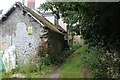
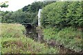
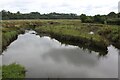
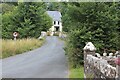
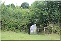
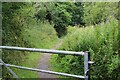
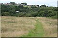
38 photos from this area
Area Information
Key information about the SA61 1LB including its size, population, and administrative classification.
- Area Type
- Postcode
- Area Size
- 3.3 hectares
- Population
- 2221
- Population Density
- 329 people/km²
House Prices in SA61 1LB
77
Properties
£136,786
Average Sold Price
£39,500
Lowest Price
£325,000
Highest Price
Showing 77 properties
| Address | Type | Beds | Baths | Last Sale Price | Last Sale Date | |
|---|---|---|---|---|---|---|
| 11 Tudor Gardens, Merlins Bridge, Haverfordwest, SA61 1LB | Semi-detached | 2 | 1 | £170,000 | Nov 2025 | |
| 65 Tudor Gardens, Merlins Bridge, Haverfordwest, SA61 1LB | Detached | 5 | 4 | £270,000 | Nov 2025 | |
| 14 Tudor Gardens, Merlins Bridge, Haverfordwest, SA61 1LB | Detached | 3 | 1 | £192,000 | Jul 2025 | |
| 75 Tudor Gardens, Merlins Bridge, Haverfordwest, SA61 1LB | Detached | 5 | 3 | £320,000 | Jun 2025 | |
| 17 Tudor Gardens, Merlins Bridge, Haverfordwest, SA61 1LB | Semi-detached | 3 | 1 | £185,000 | May 2025 | |
| 35 Tudor Gardens, Merlins Bridge, Haverfordwest, SA61 1LB | Terraced | 2 | 1 | £145,000 | Dec 2024 | |
| 73 Tudor Gardens, Merlins Bridge, Haverfordwest, SA61 1LB | Detached | 5 | 3 | £325,000 | Apr 2024 | |
| 37 Tudor Gardens, Merlins Bridge, Haverfordwest, SA61 1LB | Detached | 5 | 1 | £225,000 | Jun 2023 | |
| 49 Tudor Gardens, Merlins Bridge, Haverfordwest, SA61 1LB | Semi-detached | 3 | 1 | £145,500 | Feb 2023 | |
| 50 Tudor Gardens, Merlins Bridge, Haverfordwest, SA61 1LB | Detached | 3 | 1 | £250,000 | Sep 2022 |
Page 1 of 8
Energy Efficiency in SA61 1LB
Amenities
Schools
| Rank | School | Type | Entry gender | Ages |
|---|
Explore more schools in this area
Go to Schools tabDemographics
Household Size
Two person
most common
Accommodation Type
Houses
most common
Tenure
57
majority
Ethnic Group
White
most common
Religion
N/A
most common
Household Composition
N/A
most common
Age
47
median
Adults (30-64 years)
most common
Household Deprivation
N/A
with no deprivation
NS-SEC
22
in Lower managerial occupations
Explore more demographic insights in this area
Go to Demographics tabPlanning
Planning Constraints
- Flood RiskPremium
- Ramsar Wetland SitesPremium
- Area of Outstanding Natural BeautyPremium
- Protected Nature ReservePremium
- Protected WoodlandPremium
- Crime RiskPremium