Area Overview for SA61 1HX
Photos of SA61 1HX
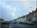
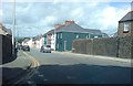
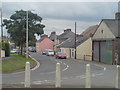
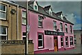

59 photos from this area
Area Information
Key information about the SA61 1HX including its size, population, and administrative classification.
- Area Type
- Postcode
- Area Size
- 9689 m²
- Population
- 2555
- Population Density
- 1280 people/km²
House Prices in SA61 1HX
16
Properties
£152,432
Average Sold Price
£133,000
Lowest Price
£188,950
Highest Price
Showing 16 properties
| Address | Type | Beds | Baths | Last Sale Price | Last Sale Date | |
|---|---|---|---|---|---|---|
| 4 Delapoer Drive, Haverfordwest, SA61 1HX | Semi-detached | 3 | 1 | £188,950 | Feb 2022 | |
| 7B Delapoer Drive, Haverfordwest, SA61 1HX | Terraced | 3 | 2 | £133,000 | Jul 2020 | |
| 7C Delapoer Drive, Haverfordwest, SA61 1HX | Terraced | 3 | 3 | £135,000 | Aug 2019 | |
| 7D Delapoer Drive, Haverfordwest, SA61 1HX | Terraced | 3 | 3 | £152,000 | Sep 2018 | |
| 7A Delapoer Drive, Haverfordwest, SA61 1HX | Semi-detached | 3 | 2 | £149,950 | Jun 2014 | |
| 4A Delapoer Drive, Haverfordwest, SA61 1HX | Semi-detached | 3 | 1 | £143,000 | Nov 2009 | |
| 13 Delapoer Drive, Haverfordwest, SA61 1HX | Semi-detached | 3 | 1 | £157,000 | Jun 2008 | |
| 3 Delapoer Drive, Haverfordwest, SA61 1HX | house | - | - | £165,000 | Mar 2005 | |
| 5 Delapoer Drive, Haverfordwest, SA61 1HX | Semi-detached | - | - | £140,950 | Dec 2004 | |
| Annedd Hyfryd, 7 Delapoer Drive, Haverfordwest, SA61 1HX | Semi-detached | 3 | - | £139,950 | Sep 2004 |
Page 1 of 2
Energy Efficiency in SA61 1HX
Amenities
Schools
| Rank | School | Type | Entry gender | Ages |
|---|
Explore more schools in this area
Go to Schools tabDemographics
Household Size
Two person
most common
Accommodation Type
Houses
most common
Tenure
72
majority
Ethnic Group
White
most common
Religion
N/A
most common
Household Composition
N/A
most common
Age
47
median
Adults (30-64 years)
most common
Household Deprivation
N/A
with no deprivation
NS-SEC
30
in Lower managerial occupations
Explore more demographic insights in this area
Go to Demographics tabPlanning
Planning Constraints
- Flood RiskPremium
- Ramsar Wetland SitesPremium
- Area of Outstanding Natural BeautyPremium
- Protected Nature ReservePremium
- Protected WoodlandPremium
- Crime RiskPremium